Showing posts with label walking. Show all posts

Saturday, 2 January 2016

BACK AGAIN !

This blog was always supposed to be a record of walks in both the U.K. and abroad.  Sadly, I have not been as diligent as I should be in keeping it up to date and I am loathe to promise to do so in 2016. However, both Gill and I are determined that we will get out on more walks this year.

2016 has got off to a start with a 4.8 mile walk around our old home town of Guiseley.  Those of you in the U.K. will be aware that the last part of December was dominated by very wet weather.  So it was good that our friend Dave planned a walk that had little tramping through mud across the fields. In fact the muddiest part of the walk was across the playground area in Menston Village !!

Many thanks to Dave for planning and leading the walk.  Also, to Sally who (despite a broken toe) stayed at home to prepare a wonderful meal for our return.  Much appreciated by all of us.

Here's tp more walks during 2016 !!

Monday, 9 February 2015

A Good Start !

Miles this Week 24.9
Miles this Month 24.9
Miles this Year 72.7

January finished with snow and ice, February has begun and, whilst it is still cold and icy, the skies have been blue. During the first week of February we've managed to get out four times, including a stroll in Cardiff, which we were visiting for the opening 6 Nations Championship match of the season and which, thankfully, England managed to pull of an unexpected victory!!
Sadly, we have not matched England's unexpected victory and at only 72.7 miles to date we are, approximately 40 miles off-target for our 1000 mile challenge. However, the year is still in it's infancy and the weather has not been kind, plus, there is a small matter of the 6 Nations to contend with and, although we do try and get some walking in prior to the matches, it is not always possible.

Feb 2nd - Otley Chevin - 7.15 miles.


This picture probably sums it up !!  Very, very icy. After a reasonably fine weekend people had obviously been out and packed the snow down which had then frozen overnight. In fact there was one section down Mitton Lane which was almost impassable; in fact we met a couple who had just taken 1/2 hour to climb approximately 800 metres!!

Otley Chevin is familiar territory to us having lived close to it for 28 years. In fact we parked at "the end of the street" where we used to live. The first part of the walk was fairly easy going. The fields slope away to the South East and had seen plenty of bright sunshine which had melted the snow. It was not until we crested the Chevin and started on the North facing slopes that the problem of ice appeared.

The section through Danefield, shielded by trees was also fairly ice free but when we once again reached the section of the Chevin beyond Surprise View our problems began again and both of us experienced the effects of gravity on at least one occasion! Still, it is a truism that in this country if you let the weather put you off, you'll never get out of the house.


Feb 4th - Baildon to Ilkley - 8.4 miles


A linear walk making use of the local train service that runs from Ilkley to Bradford. Again, we were extremely lucky with the weather with bright blue skies throughout, although the temperature rarely got above freezing. Once again, ice was the problem once we got up onto Hawksworth Moor where established paths had seen footfall which had melted and subsequently frozen to solid ice. The other problem was that footpaths were slightly indistinct on the more snowy areas.

Having said that this was a magnificent walk, high above the Wharfe Valley with long range views available throughout and whilst the going was fairly slow (it took us nearly 4 hours against an anticipated 3 1/4) we were neither in a rush, nor unable to appreciate the views offered to us.

Arriving in Ilkley we managed a well earned cup of coffee and a sandwich before catching the train back home.


February 6th - Cardiff - 5.2 miles


The arrival of the 6 Nations Championship and an opportunity to walk "abroad". For the first time in it's history the game in Wales was held on a Friday evening which gave us the opportunity to walk from the centre of Cardiff down to Cardiff Bay.  Thanks to Millenium funding Cardiff Bay has been transformed with the magnificent Millenium Centre now dominating the waterfront and shops, bars and cafes replacing what were once wharves.

Again, we were incredibly lucky with the weather which remained cold but rewarded us with bright blue skies with hardly a cloud in sight.

The game ...... for the first time in a very long time England managed a win !! They dominated the second half denying the Welsh of both possession and territory.  Many thanks also to the members of the WRU Committee who's hospitality over two evenings was superb.

Feb 8th - Kettlewell - 4.1 miles


A short "sunday stroll" in Upper Wharfedale.  The most remarkable thing about the walk was the drive to get there. Coming past Keighley the skies suddenly clouded over and we found ourselves driving through thick, freezing fog.  In fact in the space of about 2 miles the temperature went from +3 to -2.5!!  Almost as quickly once we had got past Grassington the reverse happened and, as you can see from the photograph below we were, once again, greeted with cloudless skies.


This is a very straighforward route starting from the National Parks Car Park in Kettlewell and follows a well marked footpath which follows the River Wharfe as far as the footbridge over the river at Starbotton.

Once in the village another well marked footpath climbs out of Starbotton and then follows the side of the valley until it descends back into Kettlewell. A short but beautiful walk, with both of us discarding hats, gloves and outer layers as the temperature rose to 5 degrees !

If January was disappointing then we have had a good start to February, not least with the weather. However, once again it looks as though other commitments are going to get in the way of our walking for the next couple of weeks at least and, no doubt, we will find ourselves going into March having fallen further behind our schedule ! 

Sunday, 18 January 2015

Ilkley & Grass Wood

Miles this Week 11.41
Miles this Month 37.2
Miles this Year 37.2

A bad week for walking as the weather closed in and ice and snow dominated the weekend, meaning we did not get out of the house on this particular Sunday.

Middleton & Denton - 6.52 miles

Thanks to Paul Hannon and his "Ilkley Moor" guide for this walk which is actually on the opposite side of the valley to Ilkley Moor.

The walk starts from the riverside in Ilkley where, on a damp Wednesday in January, there is plenty of parking. The first section of the walk goes through Riverside Gardens, past the rugby club, as far as the suspension bridge over the river Wharfe.
The next section can be slightly hairy as it requires moving along the busy road that runs alongside the river and which is an infamous "rat run" for those who know the area - beware speeding cars !!
Thankfully, this section is brief before cutting across fields and skirting the underside of West Park Wood, emerging onto Denton Lane and climbing to the hamlet.  This is the furthest point of the walk, which is (in reality) triangular in shape. A few more yards uphill takes you across the top side of West Park Wood and out along some very wet fields past the former Middleton Hospital and heads towards Middleton Moor, although before reaching this you turn to begin the descent through Middleton Woods and back to the rugby club before regaining the river bank for the last few metres.
A delightful walk which combined both the river, woodland and moorland, although it does have to be said that it was fairly tough going through the fields on the moor edge which were absolutely saturated.

Grass Wood - 4.89 miles

Grassington is one of those "special" places which has featured throughout my life - I first played rugby at "Upper Wharfedale" (as it was in those days) when I was in my teens and even when living in the South-East a return visit to Yorkshire would, inevitably, mean a visit to this Capital of Wharfedale.
The weather was particularly inclement for this walk. In fact had the photo opposite been taken some 5 minutes earlier it would have been completely white !! Such is the English weather that we started in a blizzard, enjoyed bright blue skies in the middle section of the walk and returned to grey and overcast weather before driving home in thick snow !!
This is a simple route following the river Wharfe upstream from Grassington - we parked in the National Parks Car Park which is not cheap but very convenient for many walks. The walk passes through Lower Grass Wood before hitting the road from Grassington to Coniston. A few yards of road walking (without the threat of speeding traffic [see above]) meets the far corner of the wood and a pleasant path leads upwards (quite steep in places) and across the woods, leading back to Grassington.

Our 1000 mile challenge is now well behind schedule - we should have walked approximately 50 miles by this point in the month. However, as previously stated we are confident that we will make up any defecit later in the year.

Sunday, 6 January 2013

Nocton to Heighington

Sunday, 6th January 2013
14.6km (9 miles) - 3hrs.


A misty day in Lincolnshire !!  I know that most people are expecting a walk in the Yorkshire Dales and surrounds but my daughter and husband have just moved into the village of Heighington, just outside Lincoln and, as we were visiting we planned and did this liner route which started in the village of Nocton and ended back at their house.  Well done to both of them for walking this distance (they're not normally walkers) and well done to Gill who hasn't been too well over the festive season but was glad to get back to walking.

As I said this was a misty walk - at one point we thought the sun might break through but, instead, the mist actually got worse as we progressed.  Sadly, this didn't make for spectacular views and even less spectacular photography.
Anyway, the walk (as stated) began in Nocton (GR : TF057643) and soon picked up a green lane (GR TF058641) which headed away from the village towards Dunston, another of the small villages that seem to dot the countryside around Lincoln. The path (although I describe it as a green path) was actually partly metalled, so it was easy going.
At the end of the path we turned left past the village school and took the next left into a cul-de-sac with an easily spotted footpath sign at the end (GR TF065632). Here we met the worst of the recent weather as we had to cross the world's wettest field (well, paddy fields excepted !).Thankfully, the field wasn't that large and we soon met the appropriately named Green Lane (GR TF076637). A straightforward dog-leg brought us out at the wonderfully named Wasps Nest (GR TF080647).
A short  stretch of road brought us to the edge of a dyke and another wonderfully named wood called Bottom Barff (I must begin to look up some of these Lincolnshire phrases !) .  The end of this stretch joined up with another green lane before we skirted Burnt Wood and Potterhanworth Wood along the top of Car Dyke.  Eventually this brought us out a Potterhanworth Booths (GR TF074679) alongside the sadly closed Plough Inn.

Unfortunately, the next couple of kilometres were along a quite busy road but we soon turned off the main road at Branston Booths (GR TF061691).  The final stretch was along small country lanes turning down Brinkle Spring Lane and back in Heighington. 

A nice walk - but no hills of course !!  We have decided that we will go around the area later in the year when we can actually see further than 200 metres in front of us.  A selection of photographs are available from this link  

Sunday, 11 November 2012

Thames Walk

Saturday, 10th November
7.46 Km (4 1/2 Miles) - 1hr 26m


So, the rugby season is upon us and, more importantly the QBE Autumn Internationals means that for four weekends I will be spending the weekend at Twickenham.  One of the problems (!) with these weekends is how to fill the void between breakfast and lunch !  Thankfully, walkit.com provided this walk at some point during the last season. Sadly I didn't record the walk then but am happy to share it now.
Luckily, we are able to stay in the Marriott Hotel which is part of the South Stand  at Twickenham so this is where the walk starts from.  The route is quite straightforward and mixes the urban with the river Thames
 and some rural views both down and across the river.  Start by going up the road, past the East Stand to the roundabout next to the Tesco supermarket.  Continue along Mogden Lane until you reach a main road.  Cross this to pick up Northcote Avenue until, once more a major road is encountered. Again, you cross this road and take a slight right to dogleg down another road (sorry, I've forgotten the name).  This street is followed until, almost by magic, the river appears next to Richmond footbridge.
From this point onwards the route is pretty straightforward as the path sticks close to the river, although it is at one point hidden from view behind houseboats.  The only difficult stretch is where the route crosses Richmond Road.  Here you need to pick up Cambridge Road before veering sharp left to pick up the river path once more.
At this point the vistas open out to reveal Ham Hill on the far side of the river and shortly afterwards Marble Hill House on the path side of the river. Not much further on the route diverts away from the river before emerging at a seating area next to the river at Twickenham itself.  Here we turn away from the river to the very busy Twickenham town centre and wander up to the Station where the stadium, and the walk end, comes into view.
This is a nice walk, and just the right length to "waste" an hour or so away from rugby!  I was lucky on the day that I walked as it had been raining quite heavily earlier in the day.  However, I was able to complete the walk without getting wet.   Some photographs of the walk give a flavour of the surroundings ! 
Oh ! and for the record England beat Fiji in the international that followed !


Sunday, 4 November 2012

Calder & Hebble Canal

Sunday, 4th November 2012
6 miles (9.78 km) - 2hrs 15min
MAP : OL21 South Pennines


A dry but very cold day.  When I left home the temperature stayed a 0c and the fog was thick and cloying. However, the mist did lift slightly by the time I got to the starting point, as did the temperature.
This walk was taken from Country Walking Magazine and downloaded from their companion website Trailzilla. I have to say that finding walks/activities on Trailzilla is not the easiest, or most intuitive but at least once found the GPS downloads are first rate.
The most difficult part of this walk was finding the start position (GR SE 095223) since the car park is not well marked. However, I did find it and immediately started walking in the wrong direction !!  I put it down to the slightly confusing directions, I'm sure the author would disagree !  Anyway, thanks to some helpful cyclists I eventually got myself on the right tracks and have to say that the rest of the walk is simplicity itself. Put simply, once on the towpath, stay on the towpath !!
The colours at this time of the year were spectacular and the walking easy and flat.  I was quite surprised at how many people, both walkers and cyclists, there were out and about on what was a bitterly cold morning. It is good to see that many more people these days take the opportunity to get outdoors.

As I say the route is straightforward, along the towpath until you encounter Sowerby Bridge marina (opposite  GR SE065236) where quite a few canal boats are moored. Just past the marina you cross the canal and double back upon yourself until meeting the Navigation Inn (GR SE067237).  Here you leave the canal and cross the bridge to a road that leads through some pretty ugly industrial estates until the River Calder is encountered (GR SE070236) and you escape the industrialisation for a path running alongside the river. 
One of the features of this first part of the walk is the proximity of houses and roads which, whilst close do not intrude on the walk itself.  The second part of the walk escapes into a more rural aspect, although the views remind you of where you actually are.
After following the river the route then cuts off and under a railway bridge (Hollas Bridge GR SE076231). Here I picked my one and only cache of the day, nicely hidden by a fence post close to the bridge. From the bridge the route then cuts quite sharply uphill giving some good views down and across the valley to the Wainhouse Tower, a famous folly that dominates the skyline. Sadly, the mist was still hanging around and I'm sure the photographs don't do the views justice.  After climbing the side of the valley you then descend sharply ending up alongside Old Rishworthians Rugby Club (GR SE084223).  A short stride takes you back under the railway bridge to rejoin the canal and back to the start point.
A I mentioned the walk started in thick, freezing fog but I'm glad to say it had lifted slightly by the end of the walk.  Most spectacular at this time of the year were the autumn colours and the fact that the walk leads through some fairly built up areas which are unobstrusive and do not spoil the walk at all.
Well,  I'm off to Twickenham during the next month.  I may get some walking done prior to the matches kicking off and will try and post some of them up here.

Thursday, 18 October 2012

Thruscross Reservoir

Thursday, 18th February 2012
15.2 km (9 1/2 miles) - 3 hrs 45 mins
Map : OS Explorer 297 - Lower Wharfedale & Washburn Valley

Thruscross is the highest of four reservoirs in the Washburn Valley, only a few miles from where I live. A Thursday off work gave me the chance to try the route above which I got from the Trailzilla site.

The walk starts from the Car Park at the very top of Fewston Reservoir (GR : SE 168553).  Care must be taken crossing the very busy A59, the main road between Skipton and Harrogate, to pick up Hall Lane (signed to West End). The road climbs steadily until it takes a sharp right turn.  The route, however, carries straight on up a green lane that carries on the steady ascent until it meets another metalled road (GR : SE 143556).  Here you turn right along Kex Gill Road until passing Burnt House on the left hand side and a footpath sign which gives on to rough pasture land.
In all honesty this was the only difficult part of the walk,although heading just to the right of West End Outdoor Centre should lead you in the right direction.
Thruscross, was the last of the four reservoirs to be built and included flooding the village of West End. The church (or chapel) was moved to higher ground, but without a congregation is now an oddly shaped outdoor centre (which I have stayed in on a couple of occasions).
From here the route is very straightforward as you follow the paths laid out by Yorkshire Water, who own the reservoir.  At first the route hugs closely to the shore of the water, passing through maintained pine woods, giving off a heady mix of resin smells on this particular day.  Whilst extremely muddy the going is not too tough, although care had to be taken due to the slippery nature of the underfoot conditions.
Emerging at the far end of the reservoir the route does take a detour up a fairly steep incline to cross Roundells Allotment before dropping back down to the shoreline again.

Eventually the dam at the end of the reservoir is crossed before dropping down the embankment and finishing the walk alongside the River Washburn itself. 

A slightly longer walk than I first anticipated but even though it is mid-October I managed this with just a base layer and fleece (discarding the fleece for the latter part of the walk).  The light was not particularly good for photography and the photos do not, perhaps, reflect the scenery that is visible.  It was however a varied walk - with hardly a soul about - taking in open moorland, the reservoir and woodland. All in all a fantastic day and my back seems to have held up, although the legs are pretty stiff !

Sunday, 7 October 2012

Evestone Lake

Sunday, 7th October
9k (5.4 miles) 2hrs 52 mins
Map : OS Explorer 26 - Nidderdale.


What a delightful October's day with temperatures reaching about 15 degrees and hardly a cloud in the sky. It seems that recently I have started each of these blogs with an apology. In this instance it was a relief to get back to walking, and back is the operative word as I've been laid up with a bad back.  Lots of pain, lots of painkillers and a complete lack of mobility.  So we decided to take a shorter than usual walk and what a cracker it turned out to be !

The walk started in the small village of Sawley, between Ripon and Pateley Bridge (GR : SE 247677). We actually had some difficulty in locating this as neither of our phones seemed capable of picking up a GPS signal. Even the handheld GPS itself seemed reluctant in the first instance to lock on to any satellites - and not a cloud in the sky !

At the south end of the village we escaped the road and walked through fields towards Lacon Hall (GR : SE 247669). After skirting the boundary of the house the route took us out to the aptly named Green Lane (GR : SE 243665).  Here, looking back we had wonderful long range views across to the Hambledon Hills - a view that remains for much of the walk.
Striking out we now headed for Butterton Bridge at the bottom of Picking Gill before climbing the other side of the gill towards Warsill Hall Farm  (GR : SE 234659). Again, the top of the ridge allowed long range views.
Across a couple of fields and we were into High Moor Plantation and a dead straight track which eventually brought us out and across the very busy B6265. However, our route still lay straight ahead towards a farm to take a sharp right turn that dropped us to Evestone Lake.
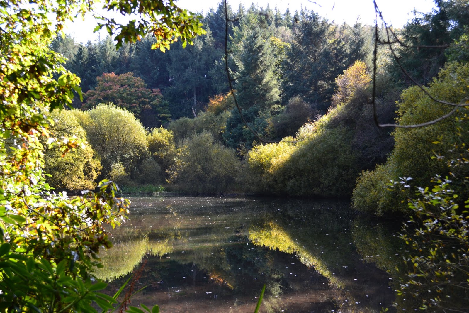
What a delightful and enchanting place this turned out to be.  The lake is, I presume, man-made and I have no idea why it was created but trees seemingly grow out of rocks at strange angles and, on our visit, hardly a murmur could be heard with the water's surface unbroken and reflecting the trees that surround it.
At the end of the lake we collected our "cache of the day" before climbing steeply through Fishpond Wood to Hollin Hill Farm (GR : SE 234682). From here it was simply a case of following the signs back to Sawley.

A delightful walk which I need to attribute to Paul Hannon and his book "Ripon and Lower Wensleydale". The joy was the superb walk around the lake, the fantastic weather and the opportunity to get some walking under the belt, but, oh how I ached afterwards !

As usual a selection of photographs taken during the walk are available from this link -- just look at those blue skies !!

Sunday, 2 September 2012

Slaidburn

Sunday, 2nd Sept  2012
10.8 km (6.7 miles) - 3hrs 7 mins
Map : OL41 Forest of Bowland and Ribblesdale


A wonderful walk in the heart of the Forest of Bowland.  The walk was published in the  August edition of "Country Walking", who have now joined up with Trailzilla.com, so that walk details and gps downloads of the walks they publish are available.  At £25.00 for a year's subscription this seems pretty good value for money and I'm hoping that we will be able to download a lot more walks during the coming months.

As the title suggests the walk starts in the hamlet of Slaidburn - about 40 mile from where I live. Plenty of parking is available (GR : SD713523) with the added advantage of toilets and a cafe right next to the parking area which seemed a particular favourite of motorcyclists.

The aim of the walk is fairly straightforward - to get to the top if Sadler Hill (approx 350m) and then back to Slaidburn but, of course, you have to get to the top first !
From the car park a short stretch of road walking is required before cutting back and across at a finger post (GR : SD715521).  The easily followed path cuts over the flank of Gaughey Hill before dropping down to Broadhead Farm.   Thanks (and a mention) must go to the owner of the farm who guided us through gates and around the sheep he had just separated with good humour, pointing us in the direction of Skelshaw (GR : 722505).

Here you pick up a rough track that slowly and inexorably gains height as you ascend Sadler Hill.
At approximately the 330m contour line the track is discarded and a "route 1" approach is adopted, straight up the hill side until the cairn on the top of Sadler Hill is spied and provides a focus for the ascent.  Here we decided to stop for some lunch and, it has to be said, there aren't many "restaurants" that could boast this view. 

After walking along the ridge a cairn appears (approx GR : SD717491) and the descent (which takes another "route 1" approach drops you directly down to a farm marked as Smelfthwaites on the map.

From hereonin the walking is much gentler and the river Hodder is soon encountered just by the village of Newton.(GR : 698502).  The remainder of the walk couldn't be simpler as the river is followed all the way back to Slaidburn and the car park.

A delightful Sunday afternoon with variable weather - despite the forecast cloud kept rolling in and the threat of rain never felt very far off.  It also has to be said that the middle stretch from Skelshaw to the top of Sadler Hill is a reasonable climb.  However, the reward is the magnificent views from the top of the hill.  Hopefully the pictures in the on-line album will reflect this.  Stiff legs but a happy heart this evening!

Another short video showing the view from the top of Sadler Hill.  (I MUST learn how to turn the sound off !!)


Sunday, 15 July 2012

Little Whernside

Sunday, July 15th 2012
13.9 km (8.6 miles) - 3hr 39 mins
Map : OL30 - Yorkshire Dales (Northern & Central)


A reasonable day, although the wind was pretty strong and probably our toughest walk of the year so far. The guide (from www.walkingworld.com) reckoned on a height gain of 330 metres but it was a fairly gentle ascent despite the pretty stiff breeze which we headed into for the outward stretch of this walk.

I have to admit I'd never heard of Little Whernside until I found this walk but it turned into a delightful Sunday afternoon and that added bit of exertion made me feel a little virtuous at the end !!

The walk starts from the car park for Scar House Reservoir  (GR : SE 070766) right ot the very top of Nidderdale.  I have to say it is a pretty popular spot and not what I expected at all.  The first section of the walk is very straightforward as you follow the road that runs along the side of the reservoir until the dam of Angram Reservoir is reached (GR :  SE 044762).  The dam takes you across to the foot of the delightfully named Pudding Hill and it is a pretty straightforward uphill pull moving in the direction of Little Whernside to gain a reasonable amount of height in a fairly short time about 100 metres in just short or a kilometre).  However, instead of dragging all the way to the top a (fairly) faint path is encountered (GR : SE034769)  which heads off to the left and contours around High Pasture and Angram Pasture whilst, at the same time, gently pushing you uphill.

It was on this section that we discovered two geocaches, the first a traditional cache (left a snowman who came from who know where ?) the second containing just a log book - but well done to those who hacked all the way out there just to place a cache ! 

The next section of the walk is pretty easy as the trek around the two pastures mentioned above meets a wall which descends from Great Whernside (GR : SE012768) - turn your back on the "big hill" and follow the wall up Little Whernside. As height was gained so the peat hag got deeper, although to be fair and given the amount of rain that has fallen it wasn't that bad !
Anyway here's a first for this blog !  A video taken opposite the cairn at the top of Little Whernside. I hope it gives you an idea of the scenery and fantastic views available - sorry, about the wind noise, nothing I can do about the howling gale !
From the top of the hill the only way was down ! Again, through peat hag and moss bog to begin with but the going got easier until we met a path (GR SE043782) which dropped back down to Scar House Reservoir and, eventually, the dam and a short stroll back to the car park !

A fanstastic day - some glorious views and whilst my bones are aching it was worth the effort.

As usual a collection of photos taken on the walk.

Let's hope the weather keeps up and that I can keep up with this blog !!

Monday, 7 May 2012

Filey

Monday, 7th May 2012
Distance : 16.2 km (10 miles). Time Taken : 3 hrs 20 mins.
Map : OS Explorer 301 (Scarborough, Bridlington & Flamborough Head)

Firstly an apology that I haven't posted anything for absolutely ages.  Rugby, the awful weather and general lethargy mean that it's been a lean year for walking. Anyway, enough of that .... a very busy weekend. Drove down to Twickenham on Friday evening ready for the RFU Cup Finals on Saturday (a mixed bag for Yorkshire clubs), then left at around 5.30 p.m. and drove up to Filey on the East Coast where my sister had booked the magnificent White House for the weekend.
This was once the "chalet" of Sir Billy Butlin when there was a Butlin's Holiday Camp at Filey. The camp is long gone but the house has been renovated and turned into two apartments - it certainly did us proud over the weekend and on Monday (Bank Holiday) Gill and I decided to do a walk I had downloaded from the internet.
I have to be honest that I can't remember where it came from and it's a .pdf so the original location has gone.  However, I'm sure if you do a search you'll be able to find it.
Thankfully we managed to find some good weather and it stayed dry for us throughout the walk (and the weekend)!
We parked (fortuitously as it turned out) in the car park next to the entrance to the golf club (GR : TA115799) and made out way through houses until we found Filey School (GR : TA109802). Here, between nos 98 and 100, a path circumnavigates the school grounds and leads up through fields until the main A165 is encountered.  A very busy road which, once crossed, allowed us to drop through fields to the village of Muston. The first yards through Muston are on footpaths but the next stage required a bit of verge hopping (again, the A1039 is a busy little road) before the the Wolds Way is picked up (GR TA091796) and the traffic left behind.  The steady climb up the side of the Wolds allows the views to expand with sights of Scarborough Castle to the North and Bempton Cliffs to the South.
The "summit" achieved the walk then goes steadily away passing Stockendale Farm (GR : TA074781) before dropping through the delightful Stockindale which becomes ever wider as you progress.

At the bottom of Stockingdale where it meets Camp Dale we managed to find a cache (long time since we did that !) before the only really steep ascent of the day, albeit a very short one ! By this point we had left the Wolds Way and were now on Centenary Way a long distance route from York to Filey. The route took us along to Field House Farm before meeting another road that droppen into Humnaby.
Once in Humnaby our route took us along Northgate and in a dead straight line to cross (once more) the A165. A short distance saw us turn up the drive of Muston Grange - sadly a caravan park, not a stately pile ! Once through the caravans a well worn path brought us out (unexpectedly) at the golf club and right next to the car park !

I think (hope) this has got us both back into the idea of walking. With the rugby season nearly over (County games at the moment) we must get back into the ROUTINE of walking.

Anyway, some picture of the whole weekend (Flat Cliffs, Bridlington and the walk) are available from this link

Sunday, 22 January 2012

Easy Keswick & Bardsey

Sunday, 22nd Jan 2012
11.2 Km (6.9 miles) - 2hrs 33 min


The beauty of where we live is that the outskirts of Leeds provide us with some wonderful winter routes that are not too far from home, are not to remote but, nevertheless, provide us with the opportunity to get away from it all.  This walk provided that with a welcome escape from home, only about 10 miles travel, yet a delightful 7 miles, although it was muddy in places.
The walk was take from Paul Hannon's  "Harrogate and the Wharfe Valley" and started in East Keswick, a sleepy dormitory town between Leeds and Wetherby. 
The route quickly escaped East Keswick and, in no time at all we were on top of Rigton Moor.  The day had started with heavy rain but thankfully this cleared and we had a very bright day with hardly a cloud in the sky.  The wind, which was also quite breezy when we started also dropped and, within a half-hour we felt over-dressed.
The route drops from Rigton Moor through Scarcroft before a delightful stretch through Hetchell Woods and into Bardsey (another of those dormitory villages).  The final climb took us back over the ridge and into East Keswick, the car and a short journey for dinner with John and Marilyn - well received after the walk.

The next month is going to see me travel further afield and, hopefully, share some walks in and around the cities that will host the Rugby Six Nations Tournament.  It all starts in a fortnight in Edinburgh !

As usual I tried to get some photos of the walk.  The bright sunshine with the sun low in the sky made this difficult and I only managed a few - available from this link.

Friday, 30 December 2011

Spofforth & Kirk Deighton

Wednesday, 28th December
10.6 km


Our last walk of 2011 and a gentle stroll along the banks of the River Crimple, or Crimple Beck as is it more popularly known.
The end of 2011 has been a bit of a disappointment in terms of walks - we just haven't seemed to find the necessary time to get out and about in the countryside, other things seem to keep getting in the way.  However, the final calculation sees me having walked 297 miles during the year, still short of that magical 300 miles mark; perhaps next year !?
The walk started in Spofforth.  Appropriate in some ways as the first walk we did in 2011 (on 1st Jan no less) also started in Spofforth.  From the village centre we headed away to the A661, the main Wetherby to Harrogate Road and, just before crossing the bridge, escaped to a marked way that runs along the side of Crimple Beck.  I must say that this was the time of year to be doing this walk as the path, although clearly marked, must be horrendously overgrown during the summer months.
The path crosses the beck after a kilometre or so and then keeps to the right hand side of the river until another stone bridge crosses back to the left hand side before cutting away up the side of a field and, eventually, turing into a metalled track that leads into Kirk Deighton.
Here we took a short detour to collect a Cache that is placed on the side of the old, and now abandoned A1. It's amazing how soon nature has reclaimed the road now that the A1 has been re-routed around Wetherby.
Back into Kirk Deighton and we headed away from the village (fast becoming a suburb of Wetherby itself) with a reasonably stiff climb into the teeth of an increasingly strong wind before crossing and then dropping on to the Harland Way.
This is, in fact, a cycle route maintained by Sustrans which follows the old railway line from Wetherby to Spofforth.  It really is easy walking on a well maintained and compact surface and the 4k was achieved in no time at all.  The route finally ends at a housing estate which leads back to the main road and into the village centre.

A relatively easy end to 2011 but good to get out into the countryside after the excesses of Christmas. a New Year's Resolution ??  Well, I'm not one for making them as it's far too easy to break them, but, I/we will try and get out into the countryside as often as possible (although there are a number of 6 Nations weekends which will take us away from Yorkshire) and I will also make an effort to keep this blog as up to date as possible, although it may be about journeys on trains and cars to Twickenham and the like !!

If you are reading this then I wish you all the very best for 2012 --- oh, well I suppose I do need to resolve that I will break that 300 mile mark next year !!

Monday, 21 November 2011

Ullswater

Saturday, 19th November
8Km (4.9 miles) 2hr 24mins

A number of weeks since we've  been walking due to other commitments and the weather.  Thankfully, this walk proved to be anything but seasonal.  Mid-November and we ended up walking in t-shirts !!
Thanks to friends John and Marilyn who had been given a free night's accomodation at the North Lakes Hotel and decided to share it with us !!  It was only fitting that I planned to Saturday afternoon excursion !

From the hotel we took the short drive to Pooley Bridge at the very top of Ullswater and, after exploring the village (a full ten minutes worth) we bought tickets for the Ullswater Steamer and boarded the boat for the short 20 minute journey to Howtown.  The weather at this stage of the day (midday) was chilly with low cloud over the hills, although there was a hint of blue. I have to say that sitting at the front of the boat I was pretty cold by the time the voyage ended !

Disembarking at Howtown Jetty (GR NY443198) a short walk leads to the road and just by the Howtown Outdoor Centre a gate gives onto the path and a short uphill stretch to another gate which gives on to a track.  The track hugs the wall as height is gained, almost inperceptably and the views spread out below you.

Also, as we gained height so did the cloud and within 10 minutes of starting the fleeces were discarded in favour of t-shirts.  The route was easy to follow and gained height almost without notice and the views became more and more extensive making it a delight to be outdoors at this time of the year.

The apex of the walk is a stone circle called The Cockpit (GR NY 482222) at approximately 330 mtrs. - 150 mtrs of ascent that hardly felt like it.  From the stone circle the anly way was downhill firstly across moorland and then along an old Roman Road that eventually became metalled and landed us back in Pooley Bridge.

A fantastic walk which, had we known what the weather was going to be like, would probably have been longer.  However, if I could  predict the weather then I wouldn't be writing this blog and the next day proved a point as, back in Yorkshire, the day from dawn to dusk was thick fog.

A selection of photos avaiable which probably don't do justice to the fantastic scenery.  Thanks to John, Marilyn and Gill for a fantastic weekend. Let's hope the weather at the weekends is better over the next few weeks and let's us get out - only 20 miles to go to crack the 300 mile mark for this year !

Sunday, 16 October 2011

Ingleton Waterfalls & Kingsdale

Sunday, 16th October
13 km (8 Miles) - 3 hr 18 min
OL2 - Yorkshire Dales (Southern and Western Areas)

Well, it's been almost three weeks since our last walk - in the meantime we have been busy moving my daughter into her new house in Lincoln (good luck to both Hannah and Alex in their new jobs and their new life in England) and also moving my father into a sheltered flat.
The latter has been quite emotional in respect that my sister and I have had to clear out the old house and, in the process, have unearthed memories of our childhood and family history that we had almost forgotten about.
In that respect this walk was also nostalgic given that (as far as I can remember) the last time I visited Ingleton's waterfalls was in my childhood - we lived some 20 miles away in the village of Langcliffe).
The walk itself really needs no detail as, once you reach the waterfalls (and pay your £5.00 entry fee), there is nowhere else to go but to follow the path that winds through woodland at first and then past Pecca Falls climbing steadily to Thornton Force.

Here's Gill stood next to the Force which, following almost a week of prolonged rain, was in good spirits !!

The going is good throughout and your £5.00 has obviously been well spent in creating and maintaining the footpaths.  A word of warning is that the outward stretch is reasonably strenuous with plenty of uphill sections - you are, after all, going against the river on this stretch and water, as we all know, flows downhill !

Just above Thornton Force the walk, which we got from the walkingworld website, deviates from the waterfall route and instead heads off up Kingdale.  A gloriously wide and flat bottomed dale with a single track road and quiet after the relatively crowded surrounds of the waterfalls.  The walk up the dale is via. the road as far as a ladder stile (GR SD702780) where we stopped for lunch next to the dried out Kingsdale Beck. Inagine our surprise then when the Beck suddenly sprang into life with the water filling as if the tide were coming in !
The route back is across meadow before a relatively easy climb over the shoulder of Wakenburgh Hill to re-join the waterfall route. 
Again, the route back is simply a case of following the signs for the waterfall walk as the return stretch down the River Doe again provides spectacular falls and gorges where the water gushed through.
By the time we got back to Ingleton the rain was fairly beating down but, I'm happy to say, my investment in a new pair of walking boots paid off as I was able to change without having wet feet !!  Congratulations to Scarpa - top class boots that didn't make my feet ache too much although it was the first time I had worn them.
Usual set of photographs is available from the link

Sunday, 11 September 2011

Dallowgill and Greygarth Monument

Sunday, 11th Sept
11.7 km (7.2 miles) 2hr 55m
Explorer 26 - Nidderdale.
A wonderful scenic walk with clear views stretching for miles, although the wind was a bit pesky towards the end!  This was another walk from Paul Hannon's "Ripon and Lower Wensleydale" book and covered ground I did in May 2010, although this walk was clockwise !
The walk starts on a stretch of moorland road (GR SE199706) that can easily be missed. Once kitted up the first section follows a moorland path that drops quickly and easily into Dallow itself (GR SE197714). Dallow can hardly be called a village only containing a couple of houses but, once the settlement is left, the scenery changes as you skirt a wood and then drop to cross the River Laver by a footbridge (GR SE190714).  A short climb takes you into woods before crossing fields to a ruined farmhouse and up through a green lane to join the road.  A short stretch along the road, followed by an equally short climb sees you arrive at Greygarth Monument (GR SE 186723).  The monument contained our only cache of the day but the ability to climb up inside the monument to a "viewing platform" afforded long range views - as far as the eye could see and right across to the North Yorkshire moors.
After spending some time at the monument the "official" route is to retrace one's steps and then double back past the monument to cross Swetton Moor.  However, being cheats we went directly from the monument, across the moor dropping down to Swetton and eventually crossing Carlesmoor Beck.
Of point of interest along this route are a number of mosaics.  There are about ten of these (some photographed in the album that accompanies this blog), each depicting some form of wildlife or livestock.
The route from Carlesmoor is a lovely lane which follows the line of the beck before emerging onto the road. A short skip up the road and another lane gives way to the right which drops back down to cross a couple of fords before rising steeply to become Belford Lane.
This joins the main road just by the Drovers Inn before a further lane (Wetshod Lane) heads out towards Skelding Moor.  The final section skirts the edge of the moor before rejoining the road for the last 1/4 mile when the parking place is regained.
A superb walk in almost total isolation.  Dallowgill seems to be one of those places that no-one has ever heard of and we only met one other group of walkers. The weather was breezy but not uncomfortable apart from the last stretch along the road when we had to walk into it.  An enjoyable afternoon where we broke the 250 miles for the year mark !!  Photos available from this link (Note: the album is called Greygarth so it does not clash with a previous Dallowgill album!)

Sunday, 4 September 2011

Oxenhope

Sunday, 4th Sept
10k (6mls) - 2hr 40m
OL21 - South Pennines

A delightful Sunday with the weather set fair giving us long distance views for miles on the "head of the valley" walk, right at the top of the Worth Valley.
Oxenhope is most famed as being the last station on the Worth Valley Railway and this walk started from the Station Car Park (GR SE032353). The walk quickly gained height as we strode up Dark Lane eventually emerging onto a back lane and dropping down to the main road before rising again to the Dog & Duck pub.
Here, thankfully, we turned off and up Sawood Lane, again gaining height pretty quickly to Cobling Farm and an amazing array of chickens and ducks (lots of variety of fowl - I need to look them up!).
From Coblilng Farm the scenery changes to moorland as Sawood Lane goes from being a metalled road, into track and, finally, moorland track.  This section was the real high point in more than one sense as the views afforded were truly spectacular.  Sadly, the camera doesn't catch these but we could make out Ingleborough in the far distance quite clearly.
After crossing the moor a road is regained (GR SE033331) and, after following it for a short distance, the route crosses fields to Intake Lane and eventually gives out at the Waggon and Horses.  After crossing the Hebden Bridge Road you descend Hard Nese Clough which was bathed in purple heather before climbing the other side of the clough to Lower Fold Farm (GR SE015345).  From here the route gradually descends along a road and then pathway to bring you back to the car park.
After the trial of strength last week this was an absolutely delightful walk with magnificent views.  The fact it took three hours less than last week and the fact that I can still walk shows that it was less than "challenging".
Link will take you to some photographs.

Sunday, 21 August 2011

Burnsall & Linton

Sunday, 21st August
11.6km (7 miles) - 2hr 40min
OL10 - Yorkshire Dales (Southern Area)
My third walk of the week (unless you count Sunday as the start of a new week !) and a walk we had promised to do a few months back but had abandoned because of the weather.  However, today was perfect walking weather - hot enough for a t-shirt, but not overwhelming - the temperature in the high teens.
I suppose one of the tips to give when trying to park in Burnsall is to arrive early.  Even at 10:30 on a Sunday morning all the "free" spaces had been taken, the riverside car park was nearly full and people were starting to arrive at the field, over the bridge.  It was certainly a differend story when we got back some three hours later when the place was cram-packed !

This is an old favourite of mine and is, to all extent and purposes, a gentle stroll rather then a walk. However, what it may lack in walking machismo it makes up for in the glory of its surroundings ! The first section is easy enough - find the river Wharfe and walk along it's banks crossing the river at the suspension bridge just North of Burnsall.  I couldn't be easier and if you feel yourself getting wet, then you've gone off course !  Along the bank we grabbed our first cache of the day at "Harry's Hollow" - just above Loup Scar where people were throwing themselves off the cliff into the river (a pastime I understand is called "tombstoning").

The river was pretty high which meant that the stepping stones across the Wharfe, just below Linton Church were not available, so we popped round the corner to cross the bridge over Linton Falls before climbing up a dropping into the village of Linton itself.

Linton is reknowned as a pretty village and it was nice to sit and have lunch overlooking the stream, although we did have guests in the shape of about twenty ducks hoping a crumb or two might fall their way !

After lunch the walk climbs up a gentle incline to join Thorpe Lane and drops into the hamlet which, reputedly, was missed by marauding Scots and became a refuge whenever the raiders from North of the Border were in the area !
The final section climbs out of Thorpe and cuts through some fields before the final stretch which can onlybe described as "stile practice" - there must be 10 or 12 stiles to negotiated before arriving back in the village and a welcome coffee at the Wharfe View Tea Rooms.

A delightful walk, although both Gill and I commented on it's seeming brevity !  Grabbed a couple of caches on the way round and took a few photographs, although the light wasn't that good.

Sunday, 24 July 2011

Top Withens

Sunday, 24th July
9.44 k (5.8 miles) - 2hr 30 m
OS OL21 - South Pennines.

Glorious walking on a perfect summer's day.  When we actually got to Top Withens the views stretched for 20 or 30 miles !!
However, getting there proved to be the most difficult part as my Sat-Nav first wanted me to do a u-turn in the middle of a three lane road and then wanted to take me down a No Through Road - and I thought technology was there to help us.  Anyway the walk begins at a car park on Moor Side Lane (GR SE 018361). Immediately opposite the car park a track runs away to Drop Farm and is clearly marked to Top Withens.
The way is very straightforward with good, clear signs and shortly after the farm strikes out across the moor before meeting a good track that heads towards Harbour Lodge (GR SD 998353).  The path circumnavigates the farm and, after a short climb, contours around Harbour Hill before dropping down Crumber Dike.  At the bottom of the Dike the Bronte Way is encountered and the path  begins to climb towards the pinnacle of the walk, and its ultimate destination.

It has to be said that the last 1/2 mile or so are a pretty sharp climb up to the ruins of Top Withens itself.  Even though we had a reasonably early start there were plenty of people around to view what is, after all, only thought to have inspiration for a place in a book !!
We carried on slightly past the farm to grab our first cache of the day - transferring a "trackable" that had first started life in Western Australia via. the Druid's Temple to its current position !!

The other point of note (and one which all guide books make) is that the signs are duplicated in Japanese, although the one in the picture is the only one I saw and no Japanese were spotted to justify their existence !
Once Top Withens had been conquered we retraced our steps down the Bronte Way eventually grabbing our second cache of the day close to Bronte Bridge (GR SD 998358).  From there the path is straightforward, although signs of erosion, and led us back to the car and a more gentle journey back without the aid of Satellite Navigation !!
A fantastic walk on a day like today - it may be different in the depths of winter.  Usual set of photographs are available

Saturday, 23 July 2011

Bingley and the 5 Rise Locks

Saturday, 23rd July
8.8 km (5.5 miles)
The inspiration for this walk will, for the time being, have to remain a mystery but we decided to do this relatively short walk which only took 1 1/2 hours, on a Saturday evening and what a bonus it turned out to be.
Firstly, the weather was aboslutely fantastic with hardly a cloud in the sky, although there was a chill wind which made it ideal for walking.  Secondly, who would have thought that the urban surroundings of Bingley - an old West Yorkshire factory town, could have provided such pleasing walking.

The walk started from the car park next to the Railway Station and, after a short distance along the Main Street cut off onto a path that skirted behind the houses and gave a real feeling of being away from it all. Having said that it was a case of "tiptoe through the dog p**" at times before emerging onto the road opposite Bradford & Bingley rugby club.

A skip across the bridge and a  gateway gives onto what looks like (and undoubtably is) someone's garden ! However, a clearly defined footpath skirts the manicured lawn and, for the next couple of miles the path hugs the banks of the River Aire and you feel as though you are truly out in the country, although looking upwards shows you the Aire Relief Road  zooming above you. 
As the footpath that follows the river dips away, the route takes you up and on to the towpath of the Leeds-Liverpool canal and over an aquaduct. From here it is a stroll back into the urban surroundings of Bingley passing one of Bingley's landmarks the Damart Factory. A short step on and you come to the world famous (?) 5 Rise Locks.  What always surprises me is the height that is gained in such a short distance.   After a trip to the top of the locks we turned and retraced our steps crossing the road by a footbridge to regain the car in the car park.   A wonderful, short walk which had plenty of interest and scenery.
Usual selection of photos are available from the link