Thursday 18 October 2012

Thruscross Reservoir

Thursday, 18th February 2012
15.2 km (9 1/2 miles) - 3 hrs 45 mins
Map : OS Explorer 297 - Lower Wharfedale & Washburn Valley

Thruscross is the highest of four reservoirs in the Washburn Valley, only a few miles from where I live. A Thursday off work gave me the chance to try the route above which I got from the Trailzilla site.

The walk starts from the Car Park at the very top of Fewston Reservoir (GR : SE 168553).  Care must be taken crossing the very busy A59, the main road between Skipton and Harrogate, to pick up Hall Lane (signed to West End). The road climbs steadily until it takes a sharp right turn.  The route, however, carries straight on up a green lane that carries on the steady ascent until it meets another metalled road (GR : SE 143556).  Here you turn right along Kex Gill Road until passing Burnt House on the left hand side and a footpath sign which gives on to rough pasture land.
In all honesty this was the only difficult part of the walk,although heading just to the right of West End Outdoor Centre should lead you in the right direction.
Thruscross, was the last of the four reservoirs to be built and included flooding the village of West End. The church (or chapel) was moved to higher ground, but without a congregation is now an oddly shaped outdoor centre (which I have stayed in on a couple of occasions).
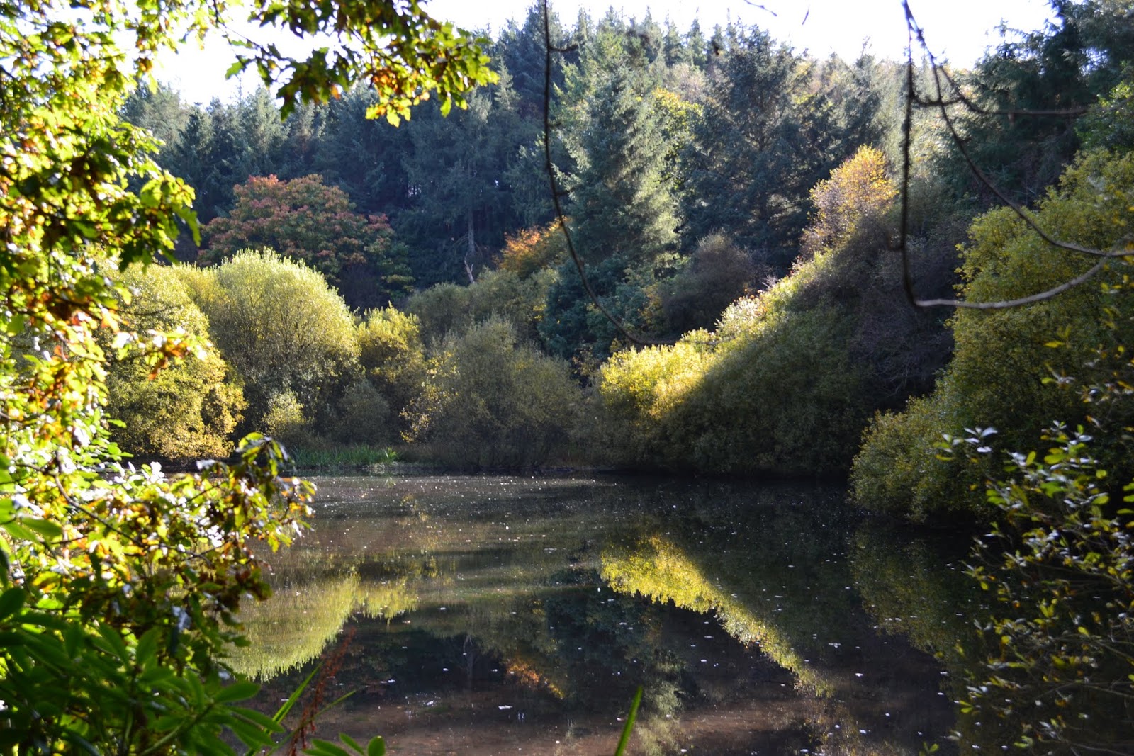
From here the route is very straightforward as you follow the paths laid out by Yorkshire Water, who own the reservoir.  At first the route hugs closely to the shore of the water, passing through maintained pine woods, giving off a heady mix of resin smells on this particular day.  Whilst extremely muddy the going is not too tough, although care had to be taken due to the slippery nature of the underfoot conditions.
Emerging at the far end of the reservoir the route does take a detour up a fairly steep incline to cross Roundells Allotment before dropping back down to the shoreline again.

Eventually the dam at the end of the reservoir is crossed before dropping down the embankment and finishing the walk alongside the River Washburn itself. 

A slightly longer walk than I first anticipated but even though it is mid-October I managed this with just a base layer and fleece (discarding the fleece for the latter part of the walk).  The light was not particularly good for photography and the photos do not, perhaps, reflect the scenery that is visible.  It was however a varied walk - with hardly a soul about - taking in open moorland, the reservoir and woodland. All in all a fantastic day and my back seems to have held up, although the legs are pretty stiff !

Sunday 7 October 2012

Evestone Lake

Sunday, 7th October
9k (5.4 miles) 2hrs 52 mins
Map : OS Explorer 26 - Nidderdale.


What a delightful October's day with temperatures reaching about 15 degrees and hardly a cloud in the sky. It seems that recently I have started each of these blogs with an apology. In this instance it was a relief to get back to walking, and back is the operative word as I've been laid up with a bad back.  Lots of pain, lots of painkillers and a complete lack of mobility.  So we decided to take a shorter than usual walk and what a cracker it turned out to be !

The walk started in the small village of Sawley, between Ripon and Pateley Bridge (GR : SE 247677). We actually had some difficulty in locating this as neither of our phones seemed capable of picking up a GPS signal. Even the handheld GPS itself seemed reluctant in the first instance to lock on to any satellites - and not a cloud in the sky !

At the south end of the village we escaped the road and walked through fields towards Lacon Hall (GR : SE 247669). After skirting the boundary of the house the route took us out to the aptly named Green Lane (GR : SE 243665).  Here, looking back we had wonderful long range views across to the Hambledon Hills - a view that remains for much of the walk.
Striking out we now headed for Butterton Bridge at the bottom of Picking Gill before climbing the other side of the gill towards Warsill Hall Farm  (GR : SE 234659). Again, the top of the ridge allowed long range views.
Across a couple of fields and we were into High Moor Plantation and a dead straight track which eventually brought us out and across the very busy B6265. However, our route still lay straight ahead towards a farm to take a sharp right turn that dropped us to Evestone Lake.
What a delightful and enchanting place this turned out to be.  The lake is, I presume, man-made and I have no idea why it was created but trees seemingly grow out of rocks at strange angles and, on our visit, hardly a murmur could be heard with the water's surface unbroken and reflecting the trees that surround it.
At the end of the lake we collected our "cache of the day" before climbing steeply through Fishpond Wood to Hollin Hill Farm (GR : SE 234682). From here it was simply a case of following the signs back to Sawley.

A delightful walk which I need to attribute to Paul Hannon and his book "Ripon and Lower Wensleydale". The joy was the superb walk around the lake, the fantastic weather and the opportunity to get some walking under the belt, but, oh how I ached afterwards !

As usual a selection of photographs taken during the walk are available from this link -- just look at those blue skies !!