Sunday 11 November 2012

Thames Walk

Saturday, 10th November
7.46 Km (4 1/2 Miles) - 1hr 26m


So, the rugby season is upon us and, more importantly the QBE Autumn Internationals means that for four weekends I will be spending the weekend at Twickenham.  One of the problems (!) with these weekends is how to fill the void between breakfast and lunch !  Thankfully, walkit.com provided this walk at some point during the last season. Sadly I didn't record the walk then but am happy to share it now.
Luckily, we are able to stay in the Marriott Hotel which is part of the South Stand  at Twickenham so this is where the walk starts from.  The route is quite straightforward and mixes the urban with the river Thames
 and some rural views both down and across the river.  Start by going up the road, past the East Stand to the roundabout next to the Tesco supermarket.  Continue along Mogden Lane until you reach a main road.  Cross this to pick up Northcote Avenue until, once more a major road is encountered. Again, you cross this road and take a slight right to dogleg down another road (sorry, I've forgotten the name).  This street is followed until, almost by magic, the river appears next to Richmond footbridge.
From this point onwards the route is pretty straightforward as the path sticks close to the river, although it is at one point hidden from view behind houseboats.  The only difficult stretch is where the route crosses Richmond Road.  Here you need to pick up Cambridge Road before veering sharp left to pick up the river path once more.
At this point the vistas open out to reveal Ham Hill on the far side of the river and shortly afterwards Marble Hill House on the path side of the river. Not much further on the route diverts away from the river before emerging at a seating area next to the river at Twickenham itself.  Here we turn away from the river to the very busy Twickenham town centre and wander up to the Station where the stadium, and the walk end, comes into view.
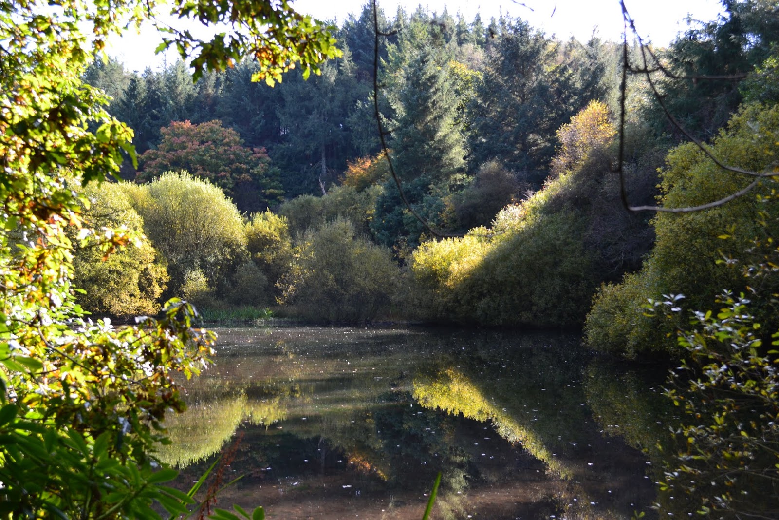
This is a nice walk, and just the right length to "waste" an hour or so away from rugby!  I was lucky on the day that I walked as it had been raining quite heavily earlier in the day.  However, I was able to complete the walk without getting wet.   Some photographs of the walk give a flavour of the surroundings ! 
Oh ! and for the record England beat Fiji in the international that followed !


Sunday 4 November 2012

Calder & Hebble Canal

Sunday, 4th November 2012
6 miles (9.78 km) - 2hrs 15min
MAP : OL21 South Pennines


A dry but very cold day.  When I left home the temperature stayed a 0c and the fog was thick and cloying. However, the mist did lift slightly by the time I got to the starting point, as did the temperature.
This walk was taken from Country Walking Magazine and downloaded from their companion website Trailzilla. I have to say that finding walks/activities on Trailzilla is not the easiest, or most intuitive but at least once found the GPS downloads are first rate.
The most difficult part of this walk was finding the start position (GR SE 095223) since the car park is not well marked. However, I did find it and immediately started walking in the wrong direction !!  I put it down to the slightly confusing directions, I'm sure the author would disagree !  Anyway, thanks to some helpful cyclists I eventually got myself on the right tracks and have to say that the rest of the walk is simplicity itself. Put simply, once on the towpath, stay on the towpath !!
The colours at this time of the year were spectacular and the walking easy and flat.  I was quite surprised at how many people, both walkers and cyclists, there were out and about on what was a bitterly cold morning. It is good to see that many more people these days take the opportunity to get outdoors.

As I say the route is straightforward, along the towpath until you encounter Sowerby Bridge marina (opposite  GR SE065236) where quite a few canal boats are moored. Just past the marina you cross the canal and double back upon yourself until meeting the Navigation Inn (GR SE067237).  Here you leave the canal and cross the bridge to a road that leads through some pretty ugly industrial estates until the River Calder is encountered (GR SE070236) and you escape the industrialisation for a path running alongside the river. 
One of the features of this first part of the walk is the proximity of houses and roads which, whilst close do not intrude on the walk itself.  The second part of the walk escapes into a more rural aspect, although the views remind you of where you actually are.
After following the river the route then cuts off and under a railway bridge (Hollas Bridge GR SE076231). Here I picked my one and only cache of the day, nicely hidden by a fence post close to the bridge. From the bridge the route then cuts quite sharply uphill giving some good views down and across the valley to the Wainhouse Tower, a famous folly that dominates the skyline. Sadly, the mist was still hanging around and I'm sure the photographs don't do the views justice.  After climbing the side of the valley you then descend sharply ending up alongside Old Rishworthians Rugby Club (GR SE084223).  A short stride takes you back under the railway bridge to rejoin the canal and back to the start point.
A I mentioned the walk started in thick, freezing fog but I'm glad to say it had lifted slightly by the end of the walk.  Most spectacular at this time of the year were the autumn colours and the fact that the walk leads through some fairly built up areas which are unobstrusive and do not spoil the walk at all.
Well,  I'm off to Twickenham during the next month.  I may get some walking done prior to the matches kicking off and will try and post some of them up here.

Thursday 18 October 2012

Thruscross Reservoir

Thursday, 18th February 2012
15.2 km (9 1/2 miles) - 3 hrs 45 mins
Map : OS Explorer 297 - Lower Wharfedale & Washburn Valley

Thruscross is the highest of four reservoirs in the Washburn Valley, only a few miles from where I live. A Thursday off work gave me the chance to try the route above which I got from the Trailzilla site.

The walk starts from the Car Park at the very top of Fewston Reservoir (GR : SE 168553).  Care must be taken crossing the very busy A59, the main road between Skipton and Harrogate, to pick up Hall Lane (signed to West End). The road climbs steadily until it takes a sharp right turn.  The route, however, carries straight on up a green lane that carries on the steady ascent until it meets another metalled road (GR : SE 143556).  Here you turn right along Kex Gill Road until passing Burnt House on the left hand side and a footpath sign which gives on to rough pasture land.
In all honesty this was the only difficult part of the walk,although heading just to the right of West End Outdoor Centre should lead you in the right direction.
Thruscross, was the last of the four reservoirs to be built and included flooding the village of West End. The church (or chapel) was moved to higher ground, but without a congregation is now an oddly shaped outdoor centre (which I have stayed in on a couple of occasions).
From here the route is very straightforward as you follow the paths laid out by Yorkshire Water, who own the reservoir.  At first the route hugs closely to the shore of the water, passing through maintained pine woods, giving off a heady mix of resin smells on this particular day.  Whilst extremely muddy the going is not too tough, although care had to be taken due to the slippery nature of the underfoot conditions.
Emerging at the far end of the reservoir the route does take a detour up a fairly steep incline to cross Roundells Allotment before dropping back down to the shoreline again.

Eventually the dam at the end of the reservoir is crossed before dropping down the embankment and finishing the walk alongside the River Washburn itself. 

A slightly longer walk than I first anticipated but even though it is mid-October I managed this with just a base layer and fleece (discarding the fleece for the latter part of the walk).  The light was not particularly good for photography and the photos do not, perhaps, reflect the scenery that is visible.  It was however a varied walk - with hardly a soul about - taking in open moorland, the reservoir and woodland. All in all a fantastic day and my back seems to have held up, although the legs are pretty stiff !

Sunday 7 October 2012

Evestone Lake

Sunday, 7th October
9k (5.4 miles) 2hrs 52 mins
Map : OS Explorer 26 - Nidderdale.


What a delightful October's day with temperatures reaching about 15 degrees and hardly a cloud in the sky. It seems that recently I have started each of these blogs with an apology. In this instance it was a relief to get back to walking, and back is the operative word as I've been laid up with a bad back.  Lots of pain, lots of painkillers and a complete lack of mobility.  So we decided to take a shorter than usual walk and what a cracker it turned out to be !

The walk started in the small village of Sawley, between Ripon and Pateley Bridge (GR : SE 247677). We actually had some difficulty in locating this as neither of our phones seemed capable of picking up a GPS signal. Even the handheld GPS itself seemed reluctant in the first instance to lock on to any satellites - and not a cloud in the sky !

At the south end of the village we escaped the road and walked through fields towards Lacon Hall (GR : SE 247669). After skirting the boundary of the house the route took us out to the aptly named Green Lane (GR : SE 243665).  Here, looking back we had wonderful long range views across to the Hambledon Hills - a view that remains for much of the walk.
Striking out we now headed for Butterton Bridge at the bottom of Picking Gill before climbing the other side of the gill towards Warsill Hall Farm  (GR : SE 234659). Again, the top of the ridge allowed long range views.
Across a couple of fields and we were into High Moor Plantation and a dead straight track which eventually brought us out and across the very busy B6265. However, our route still lay straight ahead towards a farm to take a sharp right turn that dropped us to Evestone Lake.
What a delightful and enchanting place this turned out to be.  The lake is, I presume, man-made and I have no idea why it was created but trees seemingly grow out of rocks at strange angles and, on our visit, hardly a murmur could be heard with the water's surface unbroken and reflecting the trees that surround it.
At the end of the lake we collected our "cache of the day" before climbing steeply through Fishpond Wood to Hollin Hill Farm (GR : SE 234682). From here it was simply a case of following the signs back to Sawley.

A delightful walk which I need to attribute to Paul Hannon and his book "Ripon and Lower Wensleydale". The joy was the superb walk around the lake, the fantastic weather and the opportunity to get some walking under the belt, but, oh how I ached afterwards !

As usual a selection of photographs taken during the walk are available from this link -- just look at those blue skies !!

Sunday 2 September 2012

Slaidburn

Sunday, 2nd Sept  2012
10.8 km (6.7 miles) - 3hrs 7 mins
Map : OL41 Forest of Bowland and Ribblesdale


A wonderful walk in the heart of the Forest of Bowland.  The walk was published in the  August edition of "Country Walking", who have now joined up with Trailzilla.com, so that walk details and gps downloads of the walks they publish are available.  At £25.00 for a year's subscription this seems pretty good value for money and I'm hoping that we will be able to download a lot more walks during the coming months.

As the title suggests the walk starts in the hamlet of Slaidburn - about 40 mile from where I live. Plenty of parking is available (GR : SD713523) with the added advantage of toilets and a cafe right next to the parking area which seemed a particular favourite of motorcyclists.

The aim of the walk is fairly straightforward - to get to the top if Sadler Hill (approx 350m) and then back to Slaidburn but, of course, you have to get to the top first !
From the car park a short stretch of road walking is required before cutting back and across at a finger post (GR : SD715521).  The easily followed path cuts over the flank of Gaughey Hill before dropping down to Broadhead Farm.   Thanks (and a mention) must go to the owner of the farm who guided us through gates and around the sheep he had just separated with good humour, pointing us in the direction of Skelshaw (GR : 722505).

Here you pick up a rough track that slowly and inexorably gains height as you ascend Sadler Hill.
At approximately the 330m contour line the track is discarded and a "route 1" approach is adopted, straight up the hill side until the cairn on the top of Sadler Hill is spied and provides a focus for the ascent.  Here we decided to stop for some lunch and, it has to be said, there aren't many "restaurants" that could boast this view. 

After walking along the ridge a cairn appears (approx GR : SD717491) and the descent (which takes another "route 1" approach drops you directly down to a farm marked as Smelfthwaites on the map.

From hereonin the walking is much gentler and the river Hodder is soon encountered just by the village of Newton.(GR : 698502).  The remainder of the walk couldn't be simpler as the river is followed all the way back to Slaidburn and the car park.

A delightful Sunday afternoon with variable weather - despite the forecast cloud kept rolling in and the threat of rain never felt very far off.  It also has to be said that the middle stretch from Skelshaw to the top of Sadler Hill is a reasonable climb.  However, the reward is the magnificent views from the top of the hill.  Hopefully the pictures in the on-line album will reflect this.  Stiff legs but a happy heart this evening!

Another short video showing the view from the top of Sadler Hill.  (I MUST learn how to turn the sound off !!)


Sunday 19 August 2012

Fairburn Ings

Sunday, 19th August
13.4 kms (8.3 miles) - 3hrs 10 mins


Once again it seems I have to start with an apology for not keeping this blog up to date.  I/We have, however, been keeping up our walking, it's just my record keeping and recording that are at fault. I suppose I should chastise myself and promise that I will do better, but to be honest, as long as I'm walking the recording of routes and statistics will remain secondary to actually getting some exercise.

For the record (and to salve my conscience) I did a pretty long walk - longer than it was meant to be - when on holiday in France.  The French are superb at laying out their routes with coloured poles marking the way with enough to to reassure that you are going in the right direction without there being too many to intrude.

Anyway, back to today's walk which came from "Country Walking" Magazine.  Each month they publish a range of walks across the country, there is usually one in our vicinity.

Fairburn Ings is a famous nature reserve owned and maintained by the RSPB.  Constructed (if that is the correct word) from former mining spoil it is nestled amongst former mining communities and within easy reach from our home.  It is incredible when you look at the map to see how close you are to both Leeds and Castleford, yet the tranquility of the walk was unspoilt. I still marvel that we have such easy access to beautiful and scenic countryside within a very few minutes of urban conurbations.

The walk started from the visitor centre at Fairburn Ings which is well signposted. After winding through the reserve itself a path leads you along an embankment which separates the main lake from the River Aire. The path eventually drops to the banks of the Aire (GR:  SE468272), where a further path leads across another embankment which separates bodies of water and into the village of Fairburn itself. 

The encounter with Fairburn is short lived as a path (Beckfield Lane) leads upwards onto Caudle Hill and views back over Fairburn Ings.  This easily followed path goes through Wormstall Woods before dropping into the village of Ledsham (an appropriate place for lunch).

A short section along the road (thankfully not very busy), before another path through woods took us to the village of Ledston.  Once again it is necessary to walk down the road  before picking up a pathway (named as Arrow Road on the map) which runs along the top of the reserve.  The next section of the walk was the only section where we could possibly have made a complaint as the path was very overgrown, full of nettles (my legs are still stinging) and wet after a shower we had just passed through.

Any complaint was shortlived as we emerged into pastureland with (literally) thousands of geese on it. A short stroll across the pasture (which would be quite boggy after prolonged rain I suspect) brought us back to the main road a a short step to our starting point.

Although eight miles long this was not a difficult walk (indeed the magazine grades it as easy) but was, nevertheless,  just energetic enough to make you feel that you had had some exercise.  The weather was quite hot and humid, so this suited us completely !

Usual set of pictures available from the link.

Sunday 15 July 2012

Little Whernside

Sunday, July 15th 2012
13.9 km (8.6 miles) - 3hr 39 mins
Map : OL30 - Yorkshire Dales (Northern & Central)


A reasonable day, although the wind was pretty strong and probably our toughest walk of the year so far. The guide (from www.walkingworld.com) reckoned on a height gain of 330 metres but it was a fairly gentle ascent despite the pretty stiff breeze which we headed into for the outward stretch of this walk.

I have to admit I'd never heard of Little Whernside until I found this walk but it turned into a delightful Sunday afternoon and that added bit of exertion made me feel a little virtuous at the end !!

The walk starts from the car park for Scar House Reservoir  (GR : SE 070766) right ot the very top of Nidderdale.  I have to say it is a pretty popular spot and not what I expected at all.  The first section of the walk is very straightforward as you follow the road that runs along the side of the reservoir until the dam of Angram Reservoir is reached (GR :  SE 044762).  The dam takes you across to the foot of the delightfully named Pudding Hill and it is a pretty straightforward uphill pull moving in the direction of Little Whernside to gain a reasonable amount of height in a fairly short time about 100 metres in just short or a kilometre).  However, instead of dragging all the way to the top a (fairly) faint path is encountered (GR : SE034769)  which heads off to the left and contours around High Pasture and Angram Pasture whilst, at the same time, gently pushing you uphill.

It was on this section that we discovered two geocaches, the first a traditional cache (left a snowman who came from who know where ?) the second containing just a log book - but well done to those who hacked all the way out there just to place a cache ! 

The next section of the walk is pretty easy as the trek around the two pastures mentioned above meets a wall which descends from Great Whernside (GR : SE012768) - turn your back on the "big hill" and follow the wall up Little Whernside. As height was gained so the peat hag got deeper, although to be fair and given the amount of rain that has fallen it wasn't that bad !
Anyway here's a first for this blog !  A video taken opposite the cairn at the top of Little Whernside. I hope it gives you an idea of the scenery and fantastic views available - sorry, about the wind noise, nothing I can do about the howling gale !
From the top of the hill the only way was down ! Again, through peat hag and moss bog to begin with but the going got easier until we met a path (GR SE043782) which dropped back down to Scar House Reservoir and, eventually, the dam and a short stroll back to the car park !

A fanstastic day - some glorious views and whilst my bones are aching it was worth the effort.

As usual a collection of photos taken on the walk.

Let's hope the weather keeps up and that I can keep up with this blog !!

Sunday 1 July 2012

Grassington & Hebden Gill

Sunday, 1st July
10.6 km (6.5 miles) - 2hrs 48min.

Wet, windy and misty ..... yes, you've guessed it July has just arrived !!

Once again this week has seen torrential rain and, on leaving the house, it looked as though we would be on the receiving end of more.  Thankfully, the rain was never really that bad, but the wind howled (especially as we reached higher ground) and the views were patrially obscured due to the low hanging cloud that seemed to envelop everything.

However, as Gill said, if it had been November or February we wouldn't have complained, so I'm not going to and instead will comment only on the positive which was that we got out into the countryside and had a thoroughly enjoyable walk.

The start point was the National Park car park in Grassington and the first section dropped down to Linton Falls which sounded spectacular even though we didn't actually see them. Just before reaching the footbridge across the Falls we turned left and headed off downstream until just past the fish farm (GR SE 007 630) where we turned away from the river and headed uphill passing Halfway House Farm (GR SE 011 630) and across a series of fields and stiles before arriving in the hamlet of Hebden.

Across the main road (just below the Clarendon Hotel) the route then heads up Hebden Gill past a row of delightful houses before taking on a much wilder and ragged look (especially in this weather).  The route is fairly direct following the beck before turning and going straight up to Scar Top House (GR SE 027 639). Whilst only gaining some 60-80 metres in height this is pretty tough going as it literally does go straight up and, at the top, it was time to find some shelter from the wind and some well earned lunch !

The next stretch of the walk proved just how much rain we have had as the well-defined path was, in places, ankle deep in mud.  I'm sure that on a clear day the views will be spectacular, but today the surrounding hills were sheathed in mist.

Eventually the path drops back down to the head of the Gill  (GR SE 026 653) and the opportunity for a hop and a skip across the swollen beck. From here the scenery takes on a eerie feel as the path winds it's way through disused lead mine workings and spoil heaps that are only just beginning to green over.

At last Moor Lane (GR SE 011 653) is attained and the descent back into Grassington can begin, although a delightful detour dropped us down through pastures to Bank Laithe and into the town itself.

Opportunities for walking seem limited this year.  My social calendar and the weather (why does it always seem to rain at the weekends) have also mitigated against us claiming the kind of mileage we did last year. My records show that by the beginning of July 2011 we had accrued 180 miles; this year a measly 50 is all we can boast (although, and in my defence, my record keeping has not been as diligent).  However, I don't want to be seen as a "mileage bagger", and it is good to get out even if not as regularly as last year.

As usual, a selection of picture is available from the link

Sunday 17 June 2012

Shipley Glen, The River Aire and the Leeds-Liverpool Canal

Sunday, 17th June
5.6 Miles (9.1 km) - 1hr 57mins


 Oh dear !!  Another long gap between postings ! Another long gap between walks. I must get back into the habit as the stats for this year aren't looking very good.

Anyway, this was a good walk (although not very long) and, would you believe it from the photograph, only ten minutes drive from out house.
We parked in Salts Mill Car Park (GR : SE142379) and walked past the Mills and crossed the canal into Roberts Park.  Through the park we emerged opposite Salts School and headed for the foot of Shipley Glen Tramway,  This amazing tramway has been transporting each people up the Glen for over a hundred years.  For us it was a walk up the side of the tramway (it was closed anyway !) and eventually we emerged onto the side of the Glen (GR: SE133388 - approximately). Here we encountered open moorland and a surprising number of people walking.

A further couple of kilometres on the path drops down to the head of the Glen (GR SE128400) and crossed Loadpit Beck before following the opposite side of the Glen, through a lovely wooded walk to emerge by the side of the River Aire (GR SE 130384).  The next 1/2 mile or so was up the bank of the river which, surprisingly, takes you to the towpath of the Leeds-Liverpool Canal (GR : SE122382). After crossing  the canal the route then took us across the aquaduct which keeps river and canal apart and through Hirst Wood before the final spell down the canal towpath and back to our starting point.

Whilst this was only a short walk the variety made it really interesting and it was a real joy to get back out into the open air.   Selection of photographs available from this link.

Oh, I do promise that I will get out and do more walking, and will keep this blog up to date

Monday 7 May 2012

Filey

Monday, 7th May 2012
Distance : 16.2 km (10 miles). Time Taken : 3 hrs 20 mins.
Map : OS Explorer 301 (Scarborough, Bridlington & Flamborough Head)

Firstly an apology that I haven't posted anything for absolutely ages.  Rugby, the awful weather and general lethargy mean that it's been a lean year for walking. Anyway, enough of that .... a very busy weekend. Drove down to Twickenham on Friday evening ready for the RFU Cup Finals on Saturday (a mixed bag for Yorkshire clubs), then left at around 5.30 p.m. and drove up to Filey on the East Coast where my sister had booked the magnificent White House for the weekend.
This was once the "chalet" of Sir Billy Butlin when there was a Butlin's Holiday Camp at Filey. The camp is long gone but the house has been renovated and turned into two apartments - it certainly did us proud over the weekend and on Monday (Bank Holiday) Gill and I decided to do a walk I had downloaded from the internet.
I have to be honest that I can't remember where it came from and it's a .pdf so the original location has gone.  However, I'm sure if you do a search you'll be able to find it.
Thankfully we managed to find some good weather and it stayed dry for us throughout the walk (and the weekend)!
We parked (fortuitously as it turned out) in the car park next to the entrance to the golf club (GR : TA115799) and made out way through houses until we found Filey School (GR : TA109802). Here, between nos 98 and 100, a path circumnavigates the school grounds and leads up through fields until the main A165 is encountered.  A very busy road which, once crossed, allowed us to drop through fields to the village of Muston. The first yards through Muston are on footpaths but the next stage required a bit of verge hopping (again, the A1039 is a busy little road) before the the Wolds Way is picked up (GR TA091796) and the traffic left behind.  The steady climb up the side of the Wolds allows the views to expand with sights of Scarborough Castle to the North and Bempton Cliffs to the South.
The "summit" achieved the walk then goes steadily away passing Stockendale Farm (GR : TA074781) before dropping through the delightful Stockindale which becomes ever wider as you progress.

At the bottom of Stockingdale where it meets Camp Dale we managed to find a cache (long time since we did that !) before the only really steep ascent of the day, albeit a very short one ! By this point we had left the Wolds Way and were now on Centenary Way a long distance route from York to Filey. The route took us along to Field House Farm before meeting another road that droppen into Humnaby.
Once in Humnaby our route took us along Northgate and in a dead straight line to cross (once more) the A165. A short distance saw us turn up the drive of Muston Grange - sadly a caravan park, not a stately pile ! Once through the caravans a well worn path brought us out (unexpectedly) at the golf club and right next to the car park !

I think (hope) this has got us both back into the idea of walking. With the rugby season nearly over (County games at the moment) we must get back into the ROUTINE of walking.

Anyway, some picture of the whole weekend (Flat Cliffs, Bridlington and the walk) are available from this link

Sunday 22 January 2012

Easy Keswick & Bardsey

Sunday, 22nd Jan 2012
11.2 Km (6.9 miles) - 2hrs 33 min


The beauty of where we live is that the outskirts of Leeds provide us with some wonderful winter routes that are not too far from home, are not to remote but, nevertheless, provide us with the opportunity to get away from it all.  This walk provided that with a welcome escape from home, only about 10 miles travel, yet a delightful 7 miles, although it was muddy in places.
The walk was take from Paul Hannon's  "Harrogate and the Wharfe Valley" and started in East Keswick, a sleepy dormitory town between Leeds and Wetherby. 
The route quickly escaped East Keswick and, in no time at all we were on top of Rigton Moor.  The day had started with heavy rain but thankfully this cleared and we had a very bright day with hardly a cloud in the sky.  The wind, which was also quite breezy when we started also dropped and, within a half-hour we felt over-dressed.
The route drops from Rigton Moor through Scarcroft before a delightful stretch through Hetchell Woods and into Bardsey (another of those dormitory villages).  The final climb took us back over the ridge and into East Keswick, the car and a short journey for dinner with John and Marilyn - well received after the walk.

The next month is going to see me travel further afield and, hopefully, share some walks in and around the cities that will host the Rugby Six Nations Tournament.  It all starts in a fortnight in Edinburgh !

As usual I tried to get some photos of the walk.  The bright sunshine with the sun low in the sky made this difficult and I only managed a few - available from this link.