Wednesday, 23rd June
8.75 Miles
Map : OS OL2 : Yorkshire Dales - Southern & Western Areas

 Holiday time and the chance to spend a good few hours out walking. Ingleton is a fair drive from home and this part of the world is dominated by Ingleborough which can be seen for almost all the route. This is another walk from the walkingworld.com website and, although the going is quite easy, the length of the walk makes it quite strenuous.
Parking in Ingleton you walk down to the main road and on towards the girder bridge that spans the River Greta. Just over the bridge steps lead down to the river bank which is soon left as you head across pastures towards the village of Burton in Lonsdale.
After leaving the village (and crossing the river once more), the second leg of the route takes you across Bentham Moor and drops into the village of Bentham.
The third and final stretch takes you out of Bentham and across the golf course. This section is extremely well marked and thankfully it was Wednesday so very few golfers were in evidence. After crossing the golf course it's a straight run in to Ingleton. Although I have to say I was quite foot weary by the time I got back to the car and was ready to get out of my boots.
Usual selection of photos here.
Sunday, June 20th
6.75 miles
Map : Outdoor Leisure 30 - Yorkshire Dales: Northern & Central


Glorious weather + glorious countryside = glorious day !! Another Jack Keighley walk that starts in Middleham. This is quite a drive from home - approximately 40 miles, but with the weather set fair the drive up to Ripon and then onwards to Middleham was a joy. Parking is easy enough in the centre of Middleham, although the area does get pretty busy. However, at 10:30 on a Sunday morning I managed to find a spot and donned my boots to set forward.
Middleham is horse racing country and after climbing out of the village the route heads out across the gallops. I have to say that I found this section quite difficult to follow. The printed route takes in Pinker's Pond and the OS Column on Cross Bank. Sadly, I found neither but did find the path that drops down from Fern Gill (past racing stables) to Tupgill Park. This is now "marketed" as "The Forbidden Corner - the strangest place in the world". Whether the actual park lives up to its reputation I cannot say. However, I did come across the strangest sheep that I have ever seen !!

I've no idea what breed it is and, despite looking around on the internet I'm none the wiser !
Anyway the route drops down to the floor of the valley and crosses the River Cover before heading on to the tiny hamlet of Caldbergh and eventually out onto a glorious green path that maintains the contour of the valley side. In his narrative, Keighley mentions that Coverdale is "not greatly frequented by walkers" and I can concur with that remark meeting only one other couple on the six/seven miles.
Eventually you again drop down to the river before crossing it at the wonderfully named "Hullo Bridge" , from there it is only a short distance to breach the top of the hill and the sight of Middleham Castle - a Norman structure with a huge keep - beckons you back to the centre of Middleham.
As I said it was glorious weather. Not too hot but just right for walking. The views, especially the section from Caldbergh are absolutely magnificent, well worth the drive !
Some photographs from this link - by the way, please let me know if you can identify the sheep !! It's beginning to bug me !
Sunday, 13th June
6.5 miles
Map: OS Explorer 26 - Nidderdale
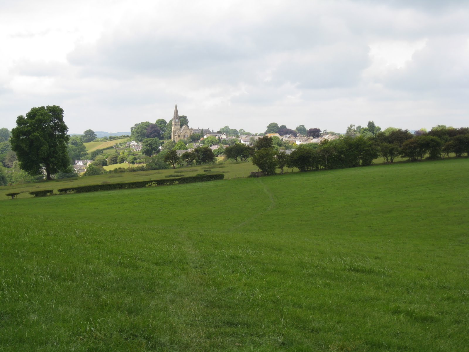
A short stroll today as I was "breaking in" new boots. Nevertheless, the walk marked a milestone as I have now done 105 miles since February ! Again, I found this walk on the walkingworld.com website, although I have to say that is not the easiest of walks to follow and Gill and I went of course twice ! We also extended the route from that shown on the map above and went on to Shaw Mills, rather than cutting across the valley at Kettle Spring. Parking in Ripley is easy with a large (free!!) Car Park as you enter the village (GR 285604). The village itself is a tourist hotspot and there were plenty of people around. However, it was not long before we escaped the crowds as we followed the Nidderdale Way out of the village, going almost due North.
The path climbs out of Ripley before dropping through woods at Cayton Gill. The peace and tranquility was only broken by birdsong and we stopped for lunch in delightful surroundings as you can see from the picture. Although the weather was dull and overcast it was warm enough to walk in shorts, although we did get one sharp shower on the route.
The Nidderdale Way eventually brings you out onto the B6165 and care needs to be taken on the 1/2 mile stretch that runs down Scarah Bank before turning on to a bridleway that heads towards Kettle Spring. Instead of taking the prescribed route which turns off just before Low Kettle Spring we continued along the Nidderdale Way until we reached the village of Shaw Mills. Here we followed Law Lane, a quiet metalled road, until we reached the collection of houses known as Bedlam.  From Bedlam the route is straightforward and soon meets the walls that surrounds Ripley Park. You simply follow the wall, not forgetting to view the deer park on the other side of the wall, until you arrive back at the front gates to Ripley Castle.
Another enjoyable Sunday afternoon. Thankfully, we managed the walk before the rain set in and the boots didn't hurt too much, although six miles was just about long enough.
A few photos available from the link
Sunday, 6th June
7.14 Miles
Map : OL10 - Yorkshire Dales - Southern Area.


Our first really wet walk of the season, which shows how dry it has been during this spring and which was evidenced by the low levels in Winterburn Reservoir, although this reservoir is not supplying drinking water but is used to maintain levels in the Leeds-Liverpool Canal.
This walk came from the superb walkingworld.com. This was suggested to me by a friend and, with a little help from one of my work colleagues who supplied me with maps for Memory Map I'm now set up to try some of the 5,000 + walks that walkingworld offers. The subscription is only £17.45 per. year, so well worth it if, like me, you try and get out walking each weekend. I may even try and devise some of my own routes!
The walk starts in the small village of Hetton (GR 963589). There is no official car park but roadside parking is available, if you get there before the Angel Inn opens ! The walk is relatively straightforward. From Hetton take Moor Lane - a broad track which leads out of the village and sets a dead straight route for the top end of the reservoir. Whilst uphill all the way it is a gradual rise eventually culminating at the convergence of five paths (GR 951608).

The way ahead is very clear and the path drops you to the head of the reservoir. A well signposted path then leads round the northern end of the reservoir and down the western side before meeting a sharp gully which forces you up and onto a farm track. A few metres down is the only tricky bit of the walk (although, again it is well signposted). This leads you across a field onto a separate farm track which you follow down into the hamlet of Winterburn.
Here we were distracted with the call of a peacock. Try as we might we could not locate it until Gill suddenly pointed to the roof of a farmhouse. Sure enough, next to the chimney, right on the apex of the roof was the offending bird ! Shortly after we encountered one of those wonders of the Dales countryside - a field full of yellow buttercups and purple clover.
The final stretch of the walk leads across another green lane - Cross Lane - which eventually meets up with Moor Lane and back into Hetton.
Perhaps not as spectacular as last week's walk and, thankfully, the heavy rain held off but, again, it was a delight to escape Guiseley and spend a few hours in the country.
Photographs are available here (including the peacock on top of the roof!).