Monday, 31st May 7.25 miles Map : OL2 Yorkshire Dales (Southern and Western Area)


Bank Holiday Monday and the last chance to get some miles in before the end of May !! Once again, this is a Jack Keighley walk but it gave me the chance to travel about 35 miles from home to the area where I was brought up. Langcliffe, where I lived until I was 12 years old, is on the other side of the valley, but this walk afforded views of the area around Langcliffe which was, in my youth, my playground - almost literally, since the kids in the village would spend hours wandering around the hills.
The walk starts from the car park in Stainforth (GR 820673). A short stroll across the road takes you over the railway and drops you down to Stainforth Bridge. Here you begin the long, steady climb past the Knights Stainforth camp site and through Little Stainforth finally emerging onto a green track that take you ever upwards ! The final section sees you break clear of the path to climb to the top of Smearsett Scar - a fair scramble with no visible path but the OS column at the tope of the scar ever beckoning. Whilst it is only a short climb it is, nevertheless, a real "lung burster". However, the reward is some magnificent views and, for Gill and myself, the perfect place for a picnic in bright, sunny weather.
After attaining the OS column the next landmark is right at the other end of the scar where there are a number of cairns on top of Pot Scar. From here the walk descends into the small hamlet of Feizor.
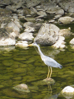
From the hamlet the next stage of the walk follows clear green paths, climbing out of the hamlet before descending into the village of Stackhouse. As soon as you reach the village you turn away and make for the River Ribble and the third section which is to simply follow the river bank back to Stainforth Bridge. Here we had the added bonus of standing and watching a heron, oblivious to us, but intent on finding his/her lunch.
Stainforth Force is just below Stainforth Bridge and a favourite spot for folks wanting to get out to the country. Our route took is back up the road to the car park and the added bonus in this warm weather of a welcome drink at the Craven Heifer in Stainforth.
A superb walk - no doubt aided by the fine weather. The climb from Stainforth Bridge to the top of Smearsett Scar is a fair drag and quite tough but the rewards for getting so high, on such a clear day gladden the heart and lift the soul.
May has been a good month for walking, particularly since it contains two Bank Holidays and I've managed 27 miles this month. The total since the beginning of February is close on 92 miles. Roll on June and some fine weather which should see me "crack the ton" !
Usual set of photgraphs are available here
London : 3.9 miles
Wednesday, 12th May

An added bonus in terms of walking this week with a trip to Twickenham and the RFU National U18 Executive Meeting. I decided to take a slightly earlier train and walk from Kings Cross Station to Vauxhall where you can pick up a train to Twickenham. The walk came from the superb walkit.com website. I simply chose London as the city I was visiting, put in my start and finish points and it produced both a map and directions from me which I could print out.
The walk had three distinct sections to it. Firtsly it took me through a number of small gardens in the environs of Kings Cross - a real bonus. I wouldn't have known they were there without the route. This also took me past Dickens House, although sadly I didn't have time to visit the museum.
The second section drops you onto the Strand and all the hustle and bustle of a London lunchtime, though I suspect it is busy whatever the time of day.
Finally, you end up on the banks of the Thames crossing the river by Hungerford Bridge and then walking along the embankment past the London Eye before things finally get a little quieter approaching Vauxhall station itself. Having said that this was the day that the new Government was being formed and Millbank, Conservative Party Headquarters was pretty busy as people were being constantly ferried to Downing Street.
It's nice to have some contrast in your walking and an "urban ramble" was needed after 2 1/2 hours on a train and the knowledge that you would be doing the same in a few hours time.
A few photos here
Dallowgill
Saturday, 15th May
6.5 miles Map : Explorer 26 - Nidderdale
Dallowgill itself is not acutallyNidderdale but a few miles East towards Kirkby Malzeard. This is another walk for Jack Keighley and his "Walks in the Yorkshire Dales" published by Cicerone.

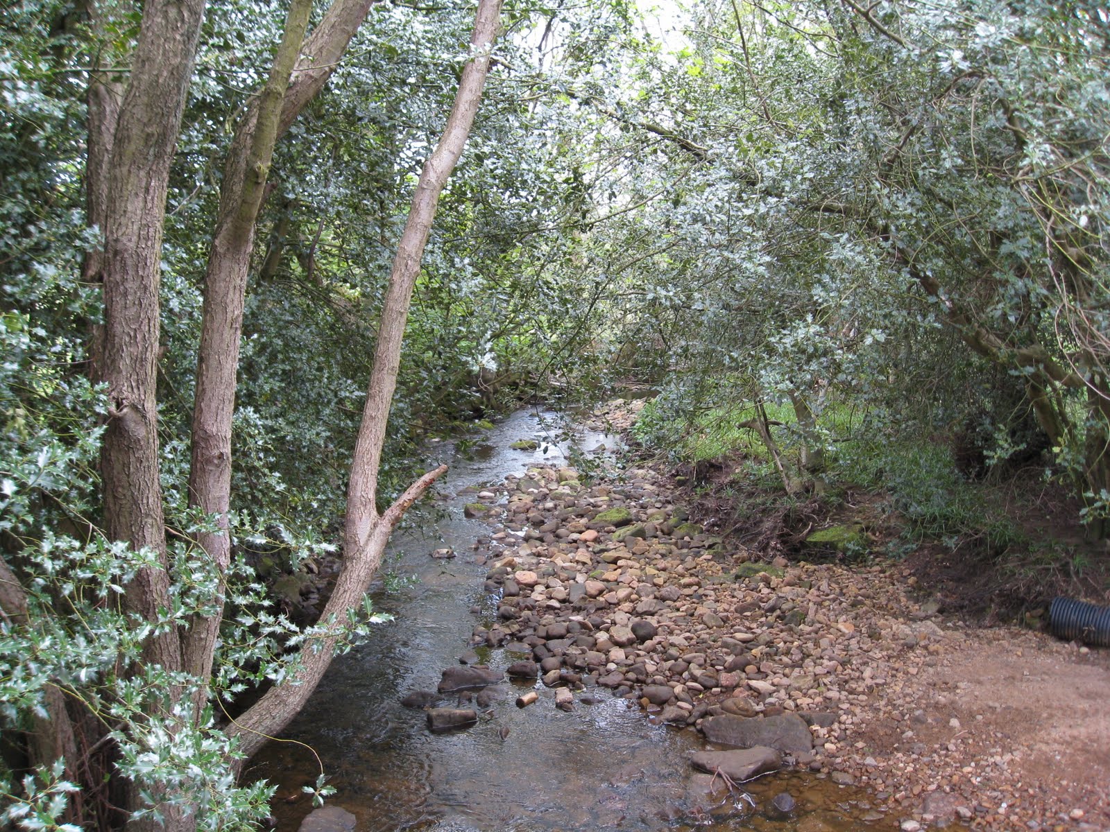
I've never heard of Dallowgill before taking this walk and it certainly is one of the quietest dales I have ever visited (although there were a fair number of people out walking). The walk starts from a quiet pull in just off the Pateley Bridge to Kirkby Malzeard road (GR 204723). The first part of the walk takes you through some lovely green paths and across becks. Really lovely in the spring sunshine. The route takes you down Belford Lane and then on to green lanes that wind down and across the bottom of the valley before emerging onto a back road.
The middle section is a fairly long uphill pull which ends up on the edge of Kirkby Malzeard Moor and the perfect place to sit down and have some lunch. This actually takes you past Carlesmoor which, like many of the "villages" on the map is just a collection of two or three houses. Whilst the weather was sunny there was a stiff breeze, so being able to find some shelter from it made lunch even more pleasant. The final section took me off to Greygarth Monument and then dropped down to Dallowgill itself and through Stang Brae which was reseplendent with thousands of bluebells and the attendant heady perfume. The final stiff climb brings you out at Dallow itself - yes just two or three house, before a final drop down and across the River Laver, nothing more than a stream really. Here you rejoin the road for the final half-mile back to the car.
Another great day out. Pictures available here
9th May - 4.17 Miles. Map : 297 - Lower Wharfedale and Washburn Valley
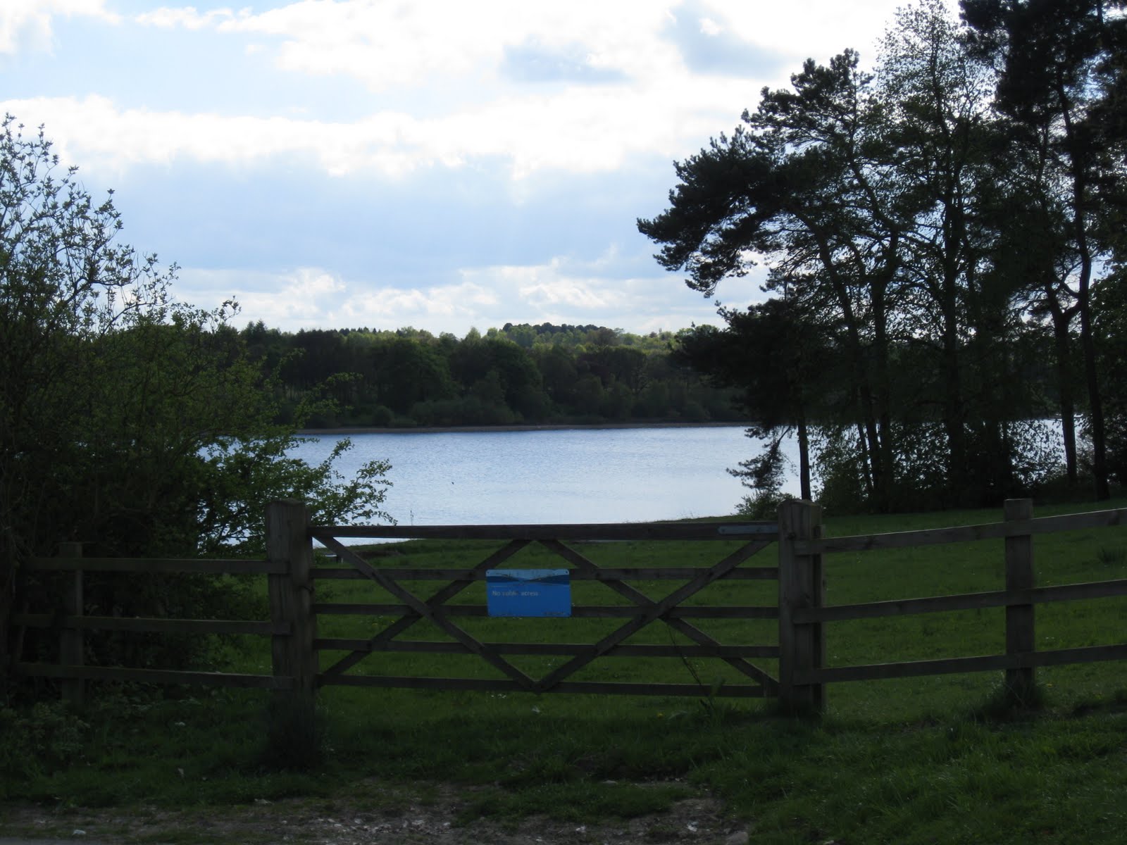
A busy Sunday, so only time for a short stroll around Eccup reservoir. The inspiration for the walk came from www.walkingenglishman.com. This site has loads of ideas for walks, each described and documented with Memory Map routes available for download if you possess the right technology (I don't!) According to the site the route is 5.2 miles long. However, my newly acquired pedometer suggests that it is slightly shorter than this at around 4 miles. It took Gill and I just over an hour, which I guess equates to round about four miles. Anyway, I've recorded it at 4.17 (6.51 km).

The route starts about five miles from where we live on Alwoodley Lane, just past Sandmoor Gold Course (GR 305408). Follow the signpost and you soon find yourself crossing the golf course before dropping down to the side of the reservoir. Thankfully, for us we managed to hit some brilliant sunshine and followed the well trodden route alongside Goodrick Plantation and, eventually onto Eccup Moor Road.
A short stride and you find yourself on the long straight road that leads towards the Treatment Works. At the far end of this the route is, again, well signposted and takes you past Owlet Hall and over the reservoir embankment. Just past the embankment turn right in front of the house and simply follow the path around the end of the reservoir eventually retracing your footsteps across the course.
A stroll rather than a ramble, with easy walking and no great exertion needed. However, a pleasant afternoon and it is good to be able to get out into the countryside so close to home.
Pictures (only a few) available form the link
3rd May - 5.5 Miles
Map : OL2 Yorkshire Dales Southern and Western Areas After a couple of weeks when we haven't been able to go walking (Gill has a better excuse than me given that she's been stranded in Florida visiting our daugther) we got back to it with a 5 1/2 mile stroll around Barden Moor.
It's fantastic to think that this scenery and the view above are available only 20 miles from our front door. Anyway the walk comes from another Cicerone Press publication "The Yorkshire Dales : South and West" by Dennis and Jan Kelsall.
The walk starts from parking space next to a cattle grid on the Barden Bridge to Embsay Road (GR 555038). The route is straightforward following well marked tracks as this is part of the Duke of Devonshire's Estate. Access is granted to these moors and the surrounding area by the Duke, although there are certain times of the year when the moors are closed. This is self evident when you see the number of Grouse butts that adorn sections of the route. It should also be noted that dogs are not allowed on these moors, especially those that have been brought up on game pie !
As I said the route is straightforward and follows the path as it winds and climbs its wayupwards heading directly (or so it seems) for the cross above Cracoe. The views are dominated by the two reservoirs and when one is level with the higher of these two you take the junction that descends down to it and over the dam that encloses the upper reservoir.
At the end of the dam turn right and keep right (the pathway forks here). The route now is donwhill towards the lower reservoir crossing Barden Beck just below two shooting shelters. The final section of the walk is a pretty steep climb back to the starting point.
A reasonable ramble to get us back into the swing of things. The weather was extremely variable with a strong wind and squally rain. If I have a criticism of the walk it is that the tracks are pretty hard underfoot and not that pleasant to walk on.
April saw us fall short of our target of doing at least 25 miles per. month and I only managed 20 miles. However, with this walk under my belt I'm now just short of 70 miles since the beginning of February.
Usual pictures are available here