Monday, 27 December 2010

Otley Chevin

Monday, 27th December
6.6 km (4.2 Miles) 1hr 25mins

Will this be the final walk of 2010? I hope not. Way back in March I set myself the target of walking 300 miles during this year.  The current total is 297 !!  I've got four days to find that extra three miles, or, alternatively I could pat myself on the back and look forward to next year and 350 !?
Sadly, the weather has put paid to walking over the past few weeks.  The walking itself would probably have been O.K. but getting to the start of the walk would have been the difficulty. No such excuses on this walk as it starts from our front door, and is one of those walks that we used to do regularly when the kids were small.  Anyway, after being "locked" indoors for the Christmas period both Gill and I felt the need to get out (and try out that new stash that Santa brought).
From the house we headed out up Moor Lane before turning off at GR SE194431 and heading up the bridleway towards Moor Farm and, eventually, Yorkgate.  Virtually straight across the road and you rise to the very edge of the Chevin and enter woodland.  Sadly, our latest attempt at geocaching proved fruitless as the snow proved too deep !
Once in the woods on the Chevin the route is easy to follow and emerges at Surpise View (GR 204441) - although on a dark, murky day there may have been a surprise but certainly no view !  In fact the view over Otley was almost surreal, as though looking at the view through cotton wool glasses !  
Keeping along the top of the Chevin the route meets an bridleway which, after crossing Yorkgate again, drops down, past fields and farms to emerge onto Carlton Lane. A short stretch along this (normally) busy road is encountered before turning off and winding one's way down to Wills Gill in Guiseley and the last pull back home.

Sadly, not a day for photography but some pictures from this link 

Sunday, 21 November 2010

Harrogate and Follifoot

Sunday, 21st November
10.8 km (6.9 miles) - 2hr 35 mins
As the year draws on so the walking gets a bit more difficult.  This 7 miles was slippery underfoot, although the weather (thankfully) stayed dry all the way and we even had some glimpes of a (very) milky sun.
This is another Paul Hannon walk from the Wharfe Valley book and it starts right on the outskirts of Harrogate near Fulwith Mill. (GR SE 313 529).
As last week I had visited the geocaching site and our first port of call was the bridge over the railway line (GR SE 320 524) where we eventually found the hidden cache and exchanged a yo-yo from the cache for some RFU stickers I had brought with us.  Childish ??  Well, finding the caches does give a little bit of something else to the walk !
If there is a bad point to this walk it was the fact that it crosses the very busy A658 twice! Even on a Sunday the traffic was roaring down the road (the Harrogate bypass) and indeed even as we sat in the middle of Follifoot having out lunch the sound of traffic was still in our ears !


The village of Follifoot is delightful and well kept and after lunch the second part of the walk took us back across the dreaded by-pass and around the outside of Rudding Park.  After dropping down and crossing Crimple Beck for the second time the route joins the Harrogate Ringway to take you back to the start.
A lovely walk that shows that the countryside is never too far away - it was only 13 miles from home to the start point. A walk dominated at the beginning and end by the magnificent Crimple Viaduct.
A few photos from this link. For the record this marked 287 miles for the year - November has proved a good month with 42 miles under the belt and another weekend left !

Sunday, 14 November 2010

Linton and Wharfedale's Green Lanes

Sunday, 14th November
16.1 Km (10.2 Miles) - 3hrs 30 Mins


My third walk in four days, clocking up 35Km in total. To be honest this was a fairly easy 16k, although there is some 100 metres of uphill on the stretch from Threshfield up to the top of the moor. This is another walk from the Walkingworld website (walk ID 2914).
The weather was changeable on the walk which starts from the village of Linton (GR SD997627).  The first stretch goes across pastureland until you meet the B6265 - a busy road that runs from Skipton up through Wharfedale. After crossing the road the walk proper begins as you head up a track that is initially tarmacced but soon turns into a green lane as it ascends Threshfield Moor.
Instead of going right up onto the moor the route crosses over to the crossroads above Winterburn Reservoir (GR SD950607).  Here Gill and I dabbled in a spot of geocaching before having a break for lunch.
After  our break we continued down the track which runs straight and true into the village of Hetton. From Hetton the next target was Rylstone and the delightful village pond that, unsually, we rush past in the car.


Once again we had to cross the busy B6265 before picking up another green lane that runs almost parallel to the road and leads into Cracoe.  A short stretch up the road again (yes, you have to cross it twice, as the footpath is on the opposite side!) the final section took us almost directly in a straight line back to our starting point.
As I said earlier this was a fairly straightforward ten miles but some of the views and the scenery are truly stunning - the mist skirting the tops of the hills and long range views up the length of Wharfedale to name two.

A few pictures from the link - the light is starting to get a bit variable as winter approaches !

Friday, 12 November 2010

Knaresborough & The Nidd Gorge

Friday, 12th November
20 Km (12.9 miles) -4 hours
OS Explorer 297 - Lower Wharfedale & Washburn Valley


A walk that, in some respects, got out of order ! I had planned to do the Nidd Gorge Walk (which came from Paul Hannon's "Harrogate and the Wharfe Valley" and to then wander around Knaresborough. Instead I combined two walks from the book and ended up with a 20 Km walk. Incidentally, this walk means I've now walked 270 miles since February this year - the plan was to walk 300 before the end of the year - looks as though I'm on track to achieve !)

Parking is available opposite "Mother Shipton's Cave" and, after the 1st November is a very reasonable £1.80 for 10 hours !! The first stage follows the "Harrogate Ringway" - a 20 mile circular walk that takes you right round the outskirts of Harrogate. This climbs out of Knaresborough amd eventually joins Bilton Lane, before turning off and heading towards Spring Wood - owned by the Woodland Trust.


The route through the woods is easily followed and well maintained, although after the past few days of torrential rain it was pretty muddy ! Eventually the path slopes down and joins the banks of the River Nidd.  This was is full flow and provided the perfect backdrop to the trees which, this year, are a particulalry beautiful blend of russets and browns. 

The route hugs the river bank with a few ups and downs until it leaves the river and cuts up, through a field to the Nidd Viaduct (GR SE307583). At this point you turn your back on the river and follow the old railway line until you meet Bilton Lane again.


Getting back to Kanresborough is just a case of following the Lane, eventually re-joining the outward stretch and back to "Mother Shipton's Cave" (closed !).


At this point I decided to continue and do the second of the Knaresborough walk in Mr. Hannon's book.  This goes downstream through the "tourist area" before climbing steeply to Crag Top - a narrow path that runs between houses and the edge of the precipice!


The route follows the road, past some pretty impressive houses before meeting the road at Grimbald Bridge.  The final section of the walk re-traces your steps, but on the opposite side of the river until you arrive back at Low Bridge, where you cross over and walk back to the car park.


The idea of combining the walks provided a good day out.  Perhaps, I should have taken a bit of break in between the walks as the last mile or so was real case of dragging feet ! However, a couple of hours and I've soaked in a hot bath and recovered ! 


Usual collection of photographs here

Sedbergh

Thursday, 11th November
8.1Km (5.6 Miles) - 2hrs
Map - OL19 (Howgill Fells and Upper Eden Valley)


Sadly, I was unable to attend my Great-Aunt Rose funeral but did manage to get time off work to visit the cemetary in Sedbergh where she now lies next to her husband Allan who died some twenty five years ago. It also gave me the opportunity to get a short walk in - although on the journey up (some sixty miles) the idea of walking in torrential rain did begin to put doubt in my mind. Thankfully, the weather cleared as I got up to Sedbergh, although it did come a good downpour as I put flowers on the grave - serves me right for missing the funeral!


Sedbergh is a small town but is completely dominated by the public school there which is almost like a suburb.  The walk came from the walkingworld website. I started from the car park opposite the school (GR SD 657919) and headed out of town and over the River Rawthey, before heading for the collection of houses known as Millthrop.  Here I saw the "green" nature of the folks around here as they had re-cycled their old wellingtons into planters (see above!). 

Shortly after passing through Millthrop the route branches off onto a green lane and climbs rapidly around the flank of Fostrow Fell before dropping back down into the valley and crossing the River Dee at Brackensgill (GR SD666893).

The next couple of kilometres are along the road before branching off and climbing to a vantage point that affords wonderful views across the town and Winder the hill which dominates it.

The final stretch took me back across the Rawthey and in and amongst the school before returning to the car park.

Despite the threat of rain I was lucky to complete the walk without getting wet and both rivers were in full spate following the recent heavy rain, which made the views spectacular, even if the bridge crossings looked a bit daunting !!  It was (I have to admit) pretty wet underfoot but even so was an average walk in terms of it's difficulty.  Well worth the long drive, and I really ought to get up into that part of the world more often!


Picture available from the link.

Sunday, 7 November 2010

Ryhill

Sunday, 7th November
10.5 Km (6.7 miles) - 1hr 54 mins
 
A gloriously clear November day, almost warm enough to walk in shorts (well, perhaps not).  I was due to be at the Ladies Roses Match held at Barnsley RUFC and, as luck would have it, this walk appeared in "Country Walking" magazine. 
I have to admit I have never heard of Ryhill and this region just South of Wakefield is not an area I would have thought of as being walking country, but the walk, although it was gentle enough, was a little gem with plenty to see and a variety of scenery.  It is certainly a popular area and both the Anglers Country Park and Haw Park Wood were full of people.
The start of the walk was not easy to find. Ryhill itself is joined to Havercroft and the road signs, whilst metioning Ryhill suddenly ran out and I found myself driving round in circles (more of that later as well).
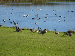
The route drops down from Ryhill to the village of Wintersett and then cuts through a field to the Anglers County Park.  Here you simply follow the path around the perimeter of the lake which was full of geese at this time of the year.

After the circuit of the lake the walk heads off for Haw Park Wood and the second section through the wood itself. Eventually this come out at the dam over Cold Hiendley Reservoir and, after crossing the road, follows the Barnsley Canal which, as well as being unused, must be the smelliest canal in England !.
The final stretch was a shady country path back up to Ryhill and the start/finish of the walk.
As for the rugby !  Well, I got horrendously lost in Barnsley and never found the ground. Despite asking for directions (including one person who claimed there was no rugby club in Barnsley) I spend 3/4 hour driving around in circles!  Hope the game was a good one and the result the right one !
Pictures available from the link

Saturday, 6 November 2010

Adel

Sunday, 31st October
11.1 Km (7.12 miles) -2hrs 10 mins

This walk is dedicated to the memory of my Great-Aunt Rose. Sadly, just as I was leaving Golden Acre Park I received a call to inform me that she had passed away at the age of 90.  A great lady who I have fond memories of.  She lived, for most of her life, as a farmer's wife in Garsdale.  A hard life in a Dales farm with little in the way of what we now take for granted - like an inside toilet ! She brought up three daughters and I have fond memories of visits and stays in the farmhouse - what it lacked in heating it made up for in the warmth of welcome.


The picture says it all !!  Wet and foggy this was more about walking, rather than looking at the scenery.  The walk came from a Leeds City Council website - unfortunately, I haven't kept the link.   The walk starts in Golden Acre Park busy even on a wet and misty morning with dog-walkers and families off to feed the birds in the park.  This route, however, head off through Breary Woods until you emerge past Pete's Pond (pictured above) and onto Cookridge Golf Course.
Thanks to the dog-walkers who put me on the right route the walk emerges on Holt Lane  and then across the very busy main road before heading across the fields to Adel Church. Again, a short walk along a road takes you into a uphill section through woods and alongside Headingley golf course.
The final section goes past Eccup Reservoir before cutting back through woods (Eccup Whin) and once more into Golden Acre Park and back to the car park.

Not a day for photographs but a few are available here

Around Derwent Water

Saturday, 23rd October
16.2 km (10.4 miles) - 3hrs 15min
The joys of the Lake District in autumn. The leaves on the trees are just starting to turn and, whilst the weather was not brilliant - it was overcast and dull - at least it did not rain.
Having been asked to spectate and select at Cumbria vs Northumberland U18 County Fixture, I took the opportunity to go the day before and completed a circuit of Derwent Water.  This is a well worn route and doesn't really need any description, in fact at times it was like walking down a High Street such were the numbers of people undertaking (I presume) the same route.
The route directions came from walkingworld.com and described the lake in an anti-clockwise direction heading out of Keswick and across to Portinscale before joining the lakeside path which is a well maintained and easily followed route. The bottom end of the lake is now another well maintained boardwalk before emerging onto the busy Borrowdale road by the Lodore hotel.
If I have any complaint about the route it was a little confusing on the return leg and I did find myself "paddling" in the water at one point.  However, I managed the longest walk to date this year in just over 3 hours.
As an afternote the next morning and the game were in brilliant, clear sunshine.  Keswick RUFC must be one of the prettiest rugby grounds in the U.K with Skiddaw dominating the scenery. Sadly, the rugby did not live up to the expectations but you can't have everything !

Some pictures from the link

Sunday, 17 October 2010

Keighley Moor

Sunday, 17th October
9.64 Kms (6.2 miles) - 2hrs 37 Mins
Map : OL 21 - South Pennines.

This is a walk we have been planning for some time (probably back in June when I first discovered it).  The weather has, unforutnately, conspired against us every time.  However, this morning we woke up to clear skies and decided that we needed to finally get out there.  We were not disappointed - a fantastic walk with great long distance views.

I orignally found the walk through a Google search on the Bradford MBC website.  The blurb that went with the walk suggested that it was only suitable for "fit, regular walkers" -whether Gill and I fit into this description may be open to debate, but we managed it in 2 1/2 hours including a break for lunch at Little Wolf Stones.
The walk began at Morkin Bridge, way up above Keighley itself. The first section is on the access road to Keighley Moor Reservoir and, whilst the road is tarmacced it does climb quite steeply up to the reservoir.

After crossing the reservoir dam the route follows tracks across the moor until you leave the way and head directly towards Little Wolf Stones.

After lunch the walk does take on a "wilderness" feel as we walked "off route" following a compass bearing and some pretty rough countryside (knee deep heather) to reach first Maw Stones and the Hitching Stone. Here we returned to more "normal" walking, although still through knee high heather until we reached the track that leads off the moor to the wonderfully named Far Slippery Farm. 
A fantastic walk - although it was only six miles, the going was tough and the legs certainly felt it by the end.

No pictures at the moment - I left the cable for the camera at work !  Hopefully, I'll post some pictures in the next couple of days.

Sunday, 10 October 2010

East Keswick, Harewood and the Wharfe

Saturday, 9th October
16.6 Km (10.6 Miles)

A dull and overcast day but, at 10.6 miles, our longest walk to date!  This walk came from the Walkingworld website - it's proving worth the small amount of money I paid to become a member!

The walk started from East Keswick, a quiet, residential village not far from Wetherby and off the beaten track.  The first section of the walk took us out of the village turning off onto Gaeton House Lane. A few twists and turns and we were on the Leeds Country Way, this is a long distance path (60 miles) that completely circles the city. Our section took us across Rigton Moor eventually emerging onto a country lane that led to the (extremely busy) A61 directly opposite the gates which allow entrance to Harewood Park. "Highlight" of this section was as we joined the Country Way the route took us through a field, in the middle of which was a dead cow !  We called at the next farm to report this only to be told by a slightly irate farmer's wife "It's been there since Monday and belongs to 'im next door" !!

This second section is actually a repeat of a walk we did back in February 2010.  It drops down into woods and through the Harewood Park Estate, emerging back on the A61 in Harewood itself.  Another stretch along and across the road led to Fitts Lane that drops some 70 metres downhill to the banks of the Wharfe.

The final stretch took us along the banks of the river before taking you through Carthick Wood and a fairly stiff climb back to the A659 (known locally as Harewood Drag) and back into the village.

Sadly the weather spoilt some of the long distance views and certainly didn't allow me to take any decent photographs.  However, it was exercise and proof that we can walk that distance.  Hopefully, next weekend will bring some brighter weather !

Sunday, 26 September 2010

Greenhow

Saturday, 25th September
13.9 km (8.9 miles) - Time 2.51 hours
Map :OS Explorer 26 - Nidderdale
With the start of the U18 Inter-County matches and my duties as a selector imminent Gill and I decided to have a Saturday off rugby and get some walking in instead. 

We parked just off the B6265 Grassington to Pateley Bridge Road at Toft Gate (GR SE128644) and our route took us downhill to Coldstonesfold Farm before climbing back up to the road and dropped us into Greenhow (GR  SE113642).

From Greenhow you enter an area that is scarred with the remains of old Lead Mines. The spoil heaps dominate the gill as do the remains of old smelting mills before we escaped onto the Nidderdale Way and tracked Ashfold Side Beck all the way down to Corn Close (GR SE148665).  The walk down the beck side was accompanied by large numbers of Grouse and Pheasant who seem to have escaped the shooters who dominate these parts during August at least.  The bottom of the valley took us through an extensive caravan park, shrouded in trees which hugs the beck side until we emerged at Corn Close and its impressive water wheel.
The final stretch of the walk took us back along the other side of the beck to Mosscar Bottom (GR SE138661) before a long uphill stretch back to Coldstonesfold Farm and a final climb back to the car park.

The weather stayed glorious throughout the walk, although there was a stiff wind, particularly at the start and finish which was some 330 metres above sea level.  The end of the walk with its almost relentless uphill trudge was strenuous but we were only about 15 miles from home so the journey (which actually went via the rugby club) allowed us time to recover.  
Another wonderful day in the country which left us thanking the fact that we have such spectacular scenery and walks just a stone's throw from out front door

Some pictures available from this link - although some of the photos are a bit "washed out" due to the brightness of the September sun!

Monday, 30 August 2010

Grisedale

Monday, 30th August
11.8 Km (7.5 miles) - Time : 3:45
Map - OL19 - Howgill Fells

Round Ing - Grisedale, North Yorkshire  
A couple of weeks since we've been walking due to holidays abroad but a glorious sunny Bank Holiday Monday was too good to miss and this was a walk back into my family history.  Round Ing - a lonely and secluded farm at the top of Grisedale is where my maternal grandmother was born.  Indeed when she and my grandfather moved to the village of Langcliffe they called their house Grisedale a name, I believe, it is still known by.

The walk started just below Garsdale Station  (SD 788918). This is a good 1 1/2 drive from home but just getting out of the car felt special and, with bright blue sky, we knew we were in for a good day's walking. 

The path from the bottom of the steep incline up to the station is easily found and within minutes we were in the seclusion of Grisedale itself.  Grisedale shot to some prominence thanks to a television documentary "The Dale That Died".  It was once home to some fourteen families but during the fifties and sixties they all moved away and gave up farming in these remote surroundings.  Apparently, the Dale has now seen something of a recovery and many of the old farms now have residents but, as we found, Round Ing, right at the end of the Dale is beyond any kind of repair and is simply a fallen down ruin with no vehicular access at all.

The first part of the route was a simple stroll up the dale.  Whilst the footpaths are indistinct, the waymarks are, in the main, well maintained and show the way up the dale - some of it accompanied by the beck that runs down the dale until we reached Round Ing (SD 764941).

After lunch in bright sunshine our route took us down the side of the valley and then up and over Grisedale Common. This was the high point of the route at some 450m. We then dropped off the top of the common towards Lunds, where we saw a deserted chapel, with gravestones from the late 19th century and headed down the valley past the delightful Ure Force Rigg before taking a (enforced!) break at the Moorcock Inn.

The last section proved a bonus as a new (not marked on the map, anyway!) bridleway allowed us to walk alongside the Settle-Carlisle railway and underneath Dandrymire Viaduct bringing us out just below the station and a couple of metres from the car.

Fantastic weather always adds to a walk and throughout we had bright sunshine with hardly a cloud in the sky.  The fact that we took in some of my family history was a bonus.  How my Great-Grandparents survived and brought up children in such remote surroundings (and in the early part of the twentieth century when cars/land rovers weren't around) amazes me. Sad that the farm is now now in such disrepair that it will never be a habitation again but it is good to see that the Dale is not Dead but remains a tranquil and remote spot.

Link to some photos

Sunday, 8 August 2010

Marske Beck

Sunday, 8th August
13K (8.3 Miles) - Time : 2.57 hrs
Map : Ordnance Survey OL30 (Northern and Central Dales)


Oh, the joys of high summer - high temperatures, high level walking and high spirits.  This was another Jack Keighley walk, although it was extended from the 5 1/4 miles in the guide book and, although it was a long drive to get there it was well worth it.

After some 50 miles of motoring the walks starts just outside the hamlet of Marske (GR 102004) between Leyburn and Richmond. A hop over the bridge and a stile offers itself alongside the beck which take you through a wooded area to emerge, eventually, onto a path that takes you through Clints Wood.  This is seemingly, run of the mill countryside until you emerge from the wood into the glory of the Dales with a steep sided valley and views of the limestone Clints Scar above. 

A short while further on and you descend to the valley bottom and the chane to visit Orgate Force .  Whilst not the most spectacular of falls compared to some it is, nevertheless, a delight. Although a word of caution after rainfall (which we have had in abundance over the last few days) - the rocks and paths can be slippery as I found out to my expense when trying to find the perfect angle for a photograph.  Had it been published it would have been of the trees with the sky above !! Slightly sore back and grazed knuckles are the result og concentrating too much of what I wanted to see, rather then where I was putting my feet.

After the delights of Orgate the next setion is a slog along a rough track, heading for Telfit Farm.  If this section is a slog, the next is sheer delight as you round the brow of the hill and take a path which hugs the contours above the beck itself.  For a brief section the walk was in perfect tranquility - peace and calm with hardly a cloud in the sky. 

Luchtime was taken just above Helwith (GR 074029). One is always tempted to envy the folks who live in these isolated farmhouses but (as I always remind Gill and myself) what must it be like in the depths of winter?  At this point Keighley's walk turns it back on the beck to climb back over the moor.  I, however, carried on alongside the beck and past Prys House (complete with dead, rotting sheep) and then cut back up past Low Greenas and High Greenas.  This gave out onto fantastic heather covered moorland eventually joining back with the published route.

The last section of the walk is a straightforward descent from the moor down a steep, rocky path and then through pasture until you rejoin the outer route just past Pillmire Bridge and back to the car.

On a personal note, I did this walk on my own as Gill is in Florida to witness Hannah (my eldest daughter) getting married to Alex.  I wish both of them the most deep felt and sincere congratulations. I hope the future brings them both happiness and fulfilment.  Times will not always be easy but I hope the love and affection they have for each other will see them through difficult times and, believe me, they are soon forgotten and it is the good times that are remembered.  They both have my love.  By the way the "proper" wedding is next year !!

As I write this, slightly sore from my fall, I think back on a wonderful day, in glorious scenery with fantastic weather - my heart is soaring !

Usual bunch of photographs here (apart from the falling down shot!) 

Sunday, 1 August 2010

Castle Howard and Farndale

Friday 30th July
Castle Howard
12.3 Km (7.9 miles)

The perils of plotting your own routes !  Sadly, this one went wrong when we were about a third of the way around when I found I had plotted a route down a private path.  Added to that the battery on the GPS went flat (forethought is a wonderful thing), so we had to resort to good old fashioned map reading !
 Our route started in Coneysthorpe, parking outside the Village Reading Rooms (GR: SE711733). As soon as we stepped outside the car we were greeted with wonderful views of Castle Howard but our route took us back towards the main road (incredibly busy for early on a Friday afternoon). Across it and on to a minor route before cutting across fields (and the only real climb of the day – although it can hardly be called that) and up through a delightful wooded pathway into the village of Ganthorpe.
Here we turned down the road and at a sharp bend expected to turn off and through woods to reach the obelisk at Castle Howard. Unfortunately, the route ahead was marked “Private” and, at the same time the GPS gave out, so it was good old map reading skills that took us past Brandrith Farm and through Brandrith Woods at just the right time as we had a downpour ! The detour brought us out just below the Gate House – our intented destination anyway.
From here the route is along road and track with views of Castle Howard, the Pyramid and the Mausoleum before joining the Centenary Way and dropping down to Bog Hall. Here, we were forced to take out second detour of the day as the planned pathway was completely overgrown with chest high nettles, even Gill and I aren’t brave enough for that !
However, the alternative was a well maintained track that dropped to the corner of the Great Lake and then climbed back to Coneysthorpe.
The area around Castle Howard is well maintained farming land and, despite the two setbacks, it was a rewarding, if slightly longer than planned walk.

Photos here

Saturday, 31st July
Farndale
10.3 Km (6.5 miles) – 2hr 55mins


Thanks to our next door neighbours, Katie and Fraser, who allowed us to rent their cottage in the delightful North Yorkshire village of Gillamoor.  This was an alternative to our original planned route and owes a lot to Frank Wilkinson and his “Walking with Wilkinson” book.  Now, sadly, out of print Wilkinson’s Walks used to appear in the Yorkshire Evening Post and this book is a collection of some of the best.
Farndale is traditionally walked in spring when the valley is full of thousands of natural daffodils. By late July the daffodils have, obviously, gone but this route hit all the right buttons.
We parked at Low Mill (GR: SE 672952) next to the Village Hall and set off along the well maintained route up the valley of the River Dove heading firstly for High Mill and then Church Houses.  The path hugs the river and, in spring, is the main “thoroughfare” through daffodil country.
From Church Houses  (GR SE669975) we then climbed out of the hamlet on Daleside Road until we reached Hall Farm (GR SE665979).  Here, a marked path takes you through the farmyard itself and climbs up to Head House Farm.  Again the route is straightforward as you drop through a valley and then head for North Gill House (GR SE673980) The path eventually give out and we followed the road across to High Bragg House (GR : SE676970).
Here we turned off and headed straight up onto Blakey Moor. This is a fairly strenuous climb of some 140 metres of height in just over a kilometre.  The latter part is through heather and bracken which makes the going underfoot fairly tough. It has to be said that this is not a well trodden route either, so you do need to be able to navigate using either a compass or GPS. Eventually, the route reaches the road on top of Blakey Ridge, some magnificent long range views and a short stroll along the road takes you to a signpost pointing the way back down the moor.
This proved almost as tough as the ascent with first heather and bracken, followed by chest high ferns! We also witnessed that most wonderful of Dales sights – the rain rushing down the valley like a curtain being drawn across a window.  Time to get the waterproofs out !
The last section is straightforward as the path off the moor turns firstly into a track and then road which runs straight back into Low Mill.
A short, fairly strenuous,  but fantastic route which had everything, but was especially memorable for those long distance views.  Getting up there may be the hard part, the rewards are well worth it.
Then it was back to the cottage to celebrate our 29th Wedding Anniversay.

Selection of photos here

Saturday, 24 July 2010

Grimwith Reservoir and Trollers Gill

Saturday, 24th July
12.5 km  (8 Miles)


I got this walk from an old Paul Hannon book, "Rambles in Wharfedale". I can vouch for it's age since, according to the record in the back of the book, I did this walk in October 1994 !! Since I can't find any mention of it on the internet I presume it is now out of print.

The walk starts from a large layby just below Stump Cross Caverns. (GR SE 084635). Walking back up the hill towards the caves a very obvious sign on the left hand side points the way towards Grimwith Reservoir and it is not long before you pass over the shoulder of Nursery Knot and see the reservoir way ahead across the fell. Surprisingly, or perhaps not considering the amount of rain we have had recently, the ground was quite wet and needed a certain amount of care when navigating the path down to the banks of the reservoir.

Grimwith Reservoir was certainly busy on this particular Saturday with both sailors and windsurfers enjoying the blustery conditions. After skirting the reservoir (apparently the largest in Yorkshire), the route takes a wonderful green path with views across Wharfedale before crossing the Grassington to Pateley Bridge Road and resuming on yet another green track.

A little further on I deviated from the route in the book to cut back on myself and then dropped down into Trollers Gill.  Described as a "sinister little ravine" there are numerous myths and legends about trolls and spectral hounds that are said to inhabit this delightful gill. Walking (or scrambling) down it on a bright summer's day it seemed very un-sinsiter
The bottom of the gill leads past Parceval Hall - the gardens are open to the public and the Hall itself is owned by a religious order and used as a place of retreat.  Eventually you drop onto Skyreholme Bank and the start of a long drag uphill back to the start of the walk.

After last week's fairly level walk this was a bit more strenuous (especially the last pull from Skyreholme). However, the weather was fair with a breeze and some glimpses of sunshine. The scenery around this part of Wharfedale is absolutely spectacular with long range views right up the valley, whilst the area around Skyreholme is dominated by the brooding presence of Simon's Seat.

Some photographs available from this link

Monday, 19 July 2010

Long Itchington & a Golden Wedding

Saturday, 17th July
13.6 km (8.7 miles)


Gill's Aunty Diana and Uncle John celebrated their Golden Wedding Annivesary this weekend and Gill, having been a bridesmaid, was (along with myself) duly invited to the celebrations held at John and Diana's farm just outside Buckingham.  This gave us the opporutnity for a walk in an area other than Yorkshire.

We had booked into a hotel in Leamington Spa for the simple reason that Charlotte, our middle daughter, was visiting her boyfriend Mike.  So we combined the chance to see Charlotte and Mike, with the Golden Wedding celebrations and the opportunity for this 8 mile walk which, in the main, was along the towpath of the Grand Union Canal.

Once again this is from the walkingworld.com website, although we found that the Memory Map Overlay (.mmo) and the walking summary varied slightly. Anyway, the map above shows the "track" rather than the "route" and, therefore, records the actual walk we took.

The walk begins in the village of Long Itchington (GR SP415652). The car park is just off a busy main road and we were met by Charlotte and Mike who joined us. The walk heads away and into the village which is a mixture of old and new.  The first part of the route then zig zags back, almost to the start in fact, before heading off down a much quieter country road and onto a bridleway before reaching the canal at Stockton Locks (GR SP429648).

Here you begin the main part of the walk which is simple enough since it follows the towpath down the Grand Union Canal, past pubs and moored narrowboats, along with those on the move until you reach Longhole Bridge (GR SP380639). Again the route here is very straigthforward following Ridgeway Lane through woods and fields until you meet Stonebridge Lane. The final stretch is straight down this lane with a final dog leg along the banks of River Itchen and back to the village.

Slightly different from some of our previous walks - the total "climb" was some 81 metres !  However, the stillness of the canal and, thankfully, lack of rain made this a pleasant stroll through the Warkwickshire countryside.

Usual bunch of photographs from this link.  Oh, and by the way, this walk marked the 150 miles so far this year!

Sunday, 11 July 2010

Bolton By Bowland

Sunday, 11th July
15 Kms (9.6 miles)


Really strong winds meant that we postponed our planned high level route and instead we headed out for our longest walk of the year to date.  This route came from Country Walking Magazine that I picked up in Leeds City Station one evening on the way back from work and, as a replacement, it was absolutely fantastic.

The land around Botlon by Bowland was, for a long time, private property and access to it was forbidden. Thankfully, the area is now accessible by all and what a joy it was.  Excellent walking and excellent scenery. 
The first section of the walk takes you from Bolton by Bowland to the village of Sawley.  There was adequate parking next to the bridge in Bolton by Bowland (GR: SD 785495), and it has the added bonus (for a Yorkshireman at least) of being free.  After leaving the village the route heads out across arable land where the farmer has "cut" the path through his crops !  Very considerate but also very easy to follow.  In not time at all the first 3km are under your belt as you emerge onto the road next to Sawley Bridge.
After crossing the bridge you pick up the Ribble Way which climbs out of Sawley and affords fantastic views of Pendle Hill - a looming presence throughout this part of the walk.  The route rises to Gisburn Cotes before dropping down to the riverside and a perfect place for a picnic !

Continuing along you eventually emerge onto the road near Gisburne Park and begin a 2km stretch along the road before leaving it at Park House Farm.  Here we purchased 1/2 dozen free range eggs for the bargain price of £1.00.  Sadly, we won't be able to return the egg box as is suggested but we are looking forward to a hearty breakfast one morning this week.

This section is slightly more indistinct than the others and is not a clearly signposted but, thanks to the GPS, we eventually emerged at the head of the village and dropped down through it to the car park.

I think both of us were feeling the strain by the end.  Me with a sore ankle and Gill with an aching hip. However, recovery did not take too long and the heart feels gladdened and stronger after some exercise through lovely countryside.


Some pictures are available from this link.   The walk means that I've now completed approximately 142 miles since February.  Can I make 150 next weekend ??

Sunday, 4 July 2010

Boston Spa

Sunday, 4th July
8 Miles
No Map but available as a
Memory Map Overlay (hope this works - first time I've done it)


This is another Paul Hannon walk from his book "Harrogate and the Wharfe Valley". This is no longer listed on the Hillside Publications website, so I presume is out of print.

Parking is easy in Boston Spa with a well marked car park in the centre of the village (GR 430456).

From the Car Park you descend Bridge Street and head off up the banks of the Wharfe until the path turns away from the river at Deepdale (GR 422464). In early July you actuall see little of the river on this stretch as the path runs high above the banks of the river and the trees and vegetation are pretty dense.

The next section of the walk is (with due respect to the residents of Boston Spa) pretty dreary as you head through the suburbs of the village and out towards Clifford. Clifford is dominated by a tall, Catholic church and this is the landmark that you need to head for (GR 430443). When outside the church turn right and head away down a small country lane before leaving that and heading out across the fields.

Our only problem came when trying to navigate around Oglethorpe Hall Farm. Here the path runs around the outside of arable fields (planted with broad beans it appears!). This is obviously not a well trodden route and the path was fairly seriously overgrown with nettles - something which my shins attest to some four hours later, even though Gill and I did rub our legs generously with dock leaves ! Anyway, the fields eventually lead to a back road and, after crossing the very busy road that runs from Boston Spa to Tadcaster, leads you back to the banks of the Wharfe.

From here it's a leisurely stroll along the banks of the river, on what turned out to be a fairly blustery day, and back to the starting point in Boston Spa.

Whilst the route was eight miles long it is virtually flat for the whole distance, so the afternoon wasn't that taxing - apart from the nettle stings that is !

Some pictures available from the link.

Wednesday, 23 June 2010

Ingleton - Burton - Bentham

Wednesday, 23rd June
8.75 Miles
Map : OS OL2 : Yorkshire Dales - Southern & Western Areas


Holiday time and the chance to spend a good few hours out walking. Ingleton is a fair drive from home and this part of the world is dominated by Ingleborough which can be seen for almost all the route. This is another walk from the walkingworld.com website and, although the going is quite easy, the length of the walk makes it quite strenuous.

Parking in Ingleton you walk down to the main road and on towards the girder bridge that spans the River Greta. Just over the bridge steps lead down to the river bank which is soon left as you head across pastures towards the village of Burton in Lonsdale.

After leaving the village (and crossing the river once more), the second leg of the route takes you across Bentham Moor and drops into the village of Bentham.

The third and final stretch takes you out of Bentham and across the golf course. This section is extremely well marked and thankfully it was Wednesday so very few golfers were in evidence. After crossing the golf course it's a straight run in to Ingleton. Although I have to say I was quite foot weary by the time I got back to the car and was ready to get out of my boots.

Usual selection of photos here.

Sunday, 20 June 2010

Middleham and Coverdale

Sunday, June 20th
6.75 miles
Map : Outdoor Leisure 30 - Yorkshire Dales: Northern & Central


Glorious weather + glorious countryside = glorious day !! Another Jack Keighley walk that starts in Middleham. This is quite a drive from home - approximately 40 miles, but with the weather set fair the drive up to Ripon and then onwards to Middleham was a joy. Parking is easy enough in the centre of Middleham, although the area does get pretty busy. However, at 10:30 on a Sunday morning I managed to find a spot and donned my boots to set forward.

Middleham is horse racing country and after climbing out of the village the route heads out across the gallops. I have to say that I found this section quite difficult to follow. The printed route takes in Pinker's Pond and the OS Column on Cross Bank. Sadly, I found neither but did find the path that drops down from Fern Gill (past racing stables) to Tupgill Park. This is now "marketed" as "The Forbidden Corner - the strangest place in the world". Whether the actual park lives up to its reputation I cannot say. However, I did come across the strangest sheep that I have ever seen !!


I've no idea what breed it is and, despite looking around on the internet I'm none the wiser !

Anyway the route drops down to the floor of the valley and crosses the River Cover before heading on to the tiny hamlet of Caldbergh and eventually out onto a glorious green path that maintains the contour of the valley side. In his narrative, Keighley mentions that Coverdale is "not greatly frequented by walkers" and I can concur with that remark meeting only one other couple on the six/seven miles.

Eventually you again drop down to the river before crossing it at the wonderfully named "Hullo Bridge" , from there it is only a short distance to breach the top of the hill and the sight of Middleham Castle - a Norman structure with a huge keep - beckons you back to the centre of Middleham.

As I said it was glorious weather. Not too hot but just right for walking. The views, especially the section from Caldbergh are absolutely magnificent, well worth the drive !

Some photographs from this link - by the way, please let me know if you can identify the sheep !! It's beginning to bug me !

Sunday, 13 June 2010

Ripley

Sunday, 13th June
6.5 miles
Map: OS Explorer 26 - Nidderdale


A short stroll today as I was "breaking in" new boots
. Nevertheless, the walk marked a milestone as I have now done 105 miles since February ! Again, I found this walk on the walkingworld.com website, although I have to say that is not the easiest of walks to follow and Gill and I went of course twice ! We also extended the route from that shown on the map above and went on to Shaw Mills, rather than cutting across the valley at Kettle Spring.


Parking in Ripley is easy with a large (free!!) Car Park as you enter the village (GR 285604). The village itself is a tourist hotspot and there were plenty of people around. However, it was not long before we escaped the crowds as we followed the Nidderdale Way out of the village, going almost due North.

The path climbs out of Ripley before dropping through woods at Cayton Gill. The peace and tranquility was only broken by birdsong and we stopped for lunch in delightful surroundings as you can see from the picture. Although the weather was dull and overcast it was warm enough to walk in shorts, although we did get one sharp shower on the route.

The Nidderdale Way eventually brings you out onto the B6165 and care needs to be taken on the 1/2 mile stretch that runs down Scarah Bank before turning on to a bridleway that heads towards Kettle Spring. Instead of taking the prescribed route which turns off just before Low Kettle Spring we continued along the Nidderdale Way until we reached the village of Shaw Mills. Here we followed Law Lane, a quiet metalled road, until we reached the collection of houses known as Bedlam.


From Bedlam the route is straightforward and soon meets the walls that surrounds Ripley Park. You simply follow the wall, not forgetting to view the deer park on the other side of the wall, until you arrive back at the front gates to Ripley Castle.

Another enjoyable Sunday afternoon. Thankfully, we managed the walk before the rain set in and the boots didn't hurt too much, although six miles was just about long enough.

A few photos available from the link